Jagersfontein Tailings Dam: Preliminary Survey Report Now Available

Since its release, the Global Industry Standard on Tailings Management (GISTM) has been widely adopted by mining companies around the world. But with the most recent tailings dam breach at Jagersfontein in September of 2022, the industry is refocusing its attention on how to improve tailings management, with special interest on legacy tailings facilities.
Investigations require time and information
The expert panels responsible for investigating dam breaches take a multi-disciplinary approach. They require months, sometimes years, to gather and review pertinent evidence before publishing their findings. The technical reports released after the Mariana dam failure in 2016 and Brumadinho dam failure in 2019 offer a glimpse into the complexity and magnitude of an investigation into a tailings dam collapse.
Investigations often reveal that multiple factors contribute to a dam’s failure. According to Azam et al. (2010), management – which includes “inappropriate dam construction procedures, improper maintenance of drainage structures, and inadequate long-term monitoring” – was identified as the primary cause in 30% of dam failures from 2000 to 2009.
Observational data (Azam, 2010) also shows that for approximately one-third of dam failures occurring between 2000 and 2009, neither the volume of released tailings nor the containment capacity were known. But without a pre-construction original ground surface, it will be difficult if not impossible for engineers to determine either of these.
Legacy assets may lack complete records

With legacy tailings facilities, survey records may be unverified or incomplete. To effectively manage legacy assets, engineers often need access to several types of data, including an original ground surface before construction and high-quality site surveys produced at regular intervals during active years.
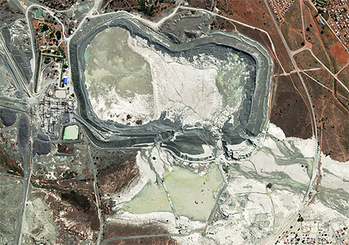
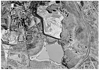
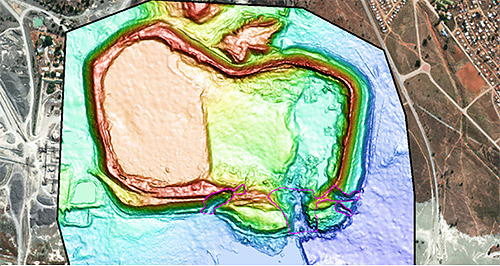
Satellite archives stretch back more than five decades, with satellite data from a variety of commercial and government programs. For Jagersfontein, archive imagery exists dating as far back as 1965. For certain years, it is possible to produce topographic surveys (DEM) that show the condition of the tailings facility throughout its life.

Preliminary survey report available
Engineers can use archive imagery, and surveys produced from them, to improve their understanding of a structure’s construction and operational history.
Get your copy of the Preliminary Survey Report on Jagersfontein here.
{{ commodity.name }}
{{ post.title }}
{{ post.date }}


Comments