JV Article: SRK Consulting’s HiveMap offers speed, accuracy and safety in mapping
SRK Consulting is officially launching HiveMap, a digital mapping and outcrop analysis software product that speeds the capture of geological observations from photogrammetry and LiDAR (light detecting and ranging) scanning tools.
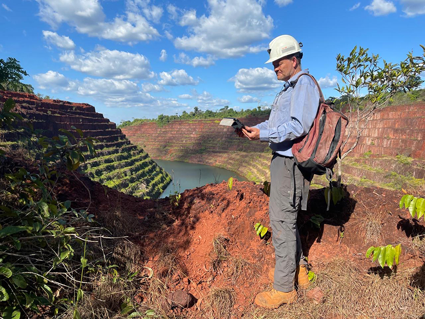
Formerly known as EasyMineXR, the rebranded and fine-tuned HiveMap allows geologists and geotechnical engineers to map without exposing themselves to risk in challenging environments both on surface and underground.
Data accuracy is fundamental for producing high-quality geological interpretations for engineering and geoscience applications. However, many open pit and underground rock exposures are not easily or safely accessible, limiting the areas that can be mapped using conventional methods in the field.
Among the most empowering applications for HiveMap are the ability to identify large-scale fault patterns and continuity for inaccessible pit slopes and perform grass roots mapping in mountainous areas, providing a scale of geological interpretation that was previously difficult to achieve.
“Conventional mapping practices required you to be up against or directly adjacent to the rock exposure, but the mining industry is now more risk averse and prohibits proximity to hazardous areas,” SRK senior rock mechanics engineer Andrew LeRiche said.
Restricted access to the rock exposure, the use of expensive, bulky hardware and the amount of time it takes for post processing to inform a 3-D model using conventional methodologies make it difficult to prioritize mapping in an operational environment, SRK principal structural geologist Findlay Fraser added. “HiveMap, by comparison, is quick and easy to use, and allows mining operations to prioritize mapping.”
Bridging the distance
HiveMap also enables collaboration and sharing that allows staff in the field to capture observations and map them on a tablet, then transfer them to a laptop-based version of the software and confer with technical staff in the head office.
“In an ideal world, we’d all go out and look at the outcrop, a pit wall or a rock face, but that’s not always feasible,” Fraser said. “HiveMap bridges that distance by bringing the rocks from the field to the office and allowing everyone to work together in a 3-D environment.”
The availability of new data collection technologies like LiDAR and photogrammetry are largely responsible for making mapping solutions like HiveMap possible, LeRiche noted.
“As recently as ten years ago, data collection methodologies like LiDAR and photogrammetry weren’t as prevalent on mine sites. LiDAR, for example, was very expensive when it was first introduced, but is now being used by many of the operations we work with,” he said.
“Using drones, we now see models being built with photogrammetry for C$1,000, and in underground scenarios we’re seeing the use of iPhones with built-in LiDAR capabilities, so the ability to collect 3-D datasets is now easier than ever.”
‘Empowering’ solution
SRK consultants are often engaged by mining companies to do field mapping, but these visits are usually annual, and often this leads to significant lengths of time between critical model updates, Fraser explained.
“It’s important that geotechnical engineers and grade control geologists on the ground are able to gather the information, make observations and map on a daily basis if it’s a critical area, but at least weekly or monthly,” he said.
“It’s not an ideal situation for an operation if mapping is so technically difficult and time consuming that you need to bring in consultants once a year.”
With HiveMap, mine staff in the field are empowered to be able to gather information and map more easily and more regularly, Fraser said.
“When I started in the mining industry, we’d be lucky to get a model update once a year,” Fraser added. “Sometimes, we had resource models in operating pits that we knew were wrong and had to rely on them for longer than was ideal because the conventional mapping tools were so difficult to use.”
In today’s mining environment, he noted, expectations with regard to the speed and accuracy of producing updated models have completely changed. But the tools to quickly and easily capture the data and feed them into 3-D models are only now catching up with those expectations.
“If you want to operate safely, you need the most accurate and up-to-date representation of your geology possible,” Fraser said. “Similarly for grade control, if a geologist sees something is not right, it’s now possible using HiveMap to map the ore boundaries and update the model for optimal material routing on an expedited basis.”
The preceding Joint Venture Article is PROMOTED CONTENT sponsored by SRK Consulting and produced in co-operation with MINING.com. For more information visit www.srk.com. For more information about HiveMap, go to www.HiveMap3d.com.


Comments