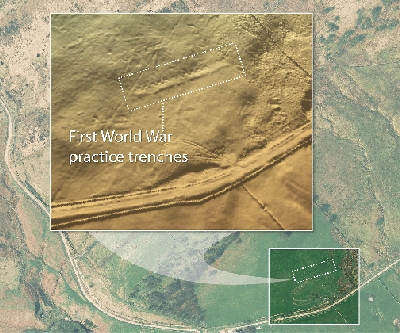
Airborne Laser Mapping Reveals First World War Trenches in Derbyshire, England
High resolution laser scanned height models may have revealed previously unrecorded First World War practice trenches. The LiDAR (Light Detection and Ranging) laser data, captured by aerial mapping company Bluesky, was commissioned by the Coal Authority as part of their research and development programme, which is looking at alternative ways to inspect mine entries in remote and rural areas.


