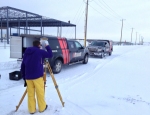
Maptek appoints Brandt as I-Site reseller in Canada

Mining technology provider Maptek has appointed Brandt Positioning Technology as a reseller of Maptek I-Site 3D mine survey systems in Canada.
Brandt Positioning Technology is the largest technology solutions provider to the survey, engineering, mapping, construction, mining, and agricultural sectors in Canada. Brandt pairs leading edge technology with a strong commitment to customer service and support.
Maptek products offered by Brandt include the I-Site 8810 and 8200 laser scanners, I-Site Studio 3D point cloud software, and the PerfectDig conformance system. I-Site and PerfectDig technologies are widely deployed in mining and civil engineering applications where accurate survey and 3D modelling is fundamental to productivity.
The extra-long range I-Site 8810 laser scanner is the system of choice for large open pit, highwall and topographical survey, acquiring detailed data out to 2 kilometres. The integrated high resolution digital panoramic camera captures imagery for overlay on the point cloud. The integrated digital compass and GPS, and ruggedised tablet make the system easy to set up and operate. The IP65 rating certifies that the scanner can withstand harsh environments.
The I-Site 8200 laser scanner, released in 2013, targets underground measurement of voids, drives and tunnels. It can also handle indoor silo survey and stockpile volumes. The 125-degree scanning aperture, IP65 rating, onboard controls, and extendible 10 m carbon fibre boom make the I-Site 8200 laser scanner a flexible survey solution.
Point cloud data is easily processed in I-Site Studio, with workflows that streamline routine survey applications. Models, animations and 3D PDFs promote clear communication between stakeholders.
PerfectDig, also released in 2013, compares I-Site scans and pit models to allow real-time monitoring of excavation against design. Variations can be accounted for before excavators leave the area, and highwall issues can be identified early.
‘We are very excited to be the dealer for Maptek in Canada as this product line greatly enhances our offering for our Positioning & Mining customers. The reason we went with the Maptek product was their reputation in the mining industry and it is the most robust product in the market place,’ said Joe Chisholm, Brandt Division Manager.
‘In Canada, our customers need to operate in extreme temperatures and conditions so we cannot afford to sell a “toy” scanner. Another feature we could not ignore was the operating range of Maptek scanners – nothing else comes close. It ensures our clients in heavy construction, civil and mining are operating within a safe distance, meeting their safety expectations. The I-Site software is the best we have seen for operator ease of use and efficient delivery of the finished product. PerfectDig also complements Brandt’s construction product line with volume scanning solutions.’
‘We are very excited to have Brandt on board as a Canadian reseller,’ said Leo Krenzel, Maptek I-Site Technical Sales. ‘The local experience and expertise in positioning technology will help Maptek better service the Canadian survey market.’
About Brandt Positioning Technology
Brandt Positioning Technology (part of the Brandt Group of Companies) provides technology solutions to the survey, engineering, mapping, construction, mining, and agriculture sectors. Through a nationwide network of 27 Brandt Tractor dealerships, they deliver value to customers by providing better, more innovative, total positioning solutions. Brandt pairs leading edge technology with a strong commitment to superior customer service and support. Visit www.brandt.ca
For more information on Brandt’s Positioning Technology Division contact Joe Chisholm at +1-780-733-1492
About Maptek
Maptek™ is a leading provider of innovative software, hardware and services for the global mining industry. Maptek products are in use at more than 1700 sites in more than 65 countries. Vulcan™ is one of the world’s longest standing 3D mine planning and modelling packages. I-Site™ is an integrated hardware and software system for 3D laser scanning, surveying and imaging. Maptek PerfectDig is an augmented reality system used to evaluate and support design conformance. BlastLogic™ is intelligent 3D drillhole validation and load design software, and Eureka™ provides an interactive 3D environment for visualising and interpreting geophysical and seismic data.
Visit www.maptek.com
{{ commodity.name }}
{{ post.title }}
{{ post.date }}


Comments