Major North American energy firm boosts productivity with drone mine surveys [case study]
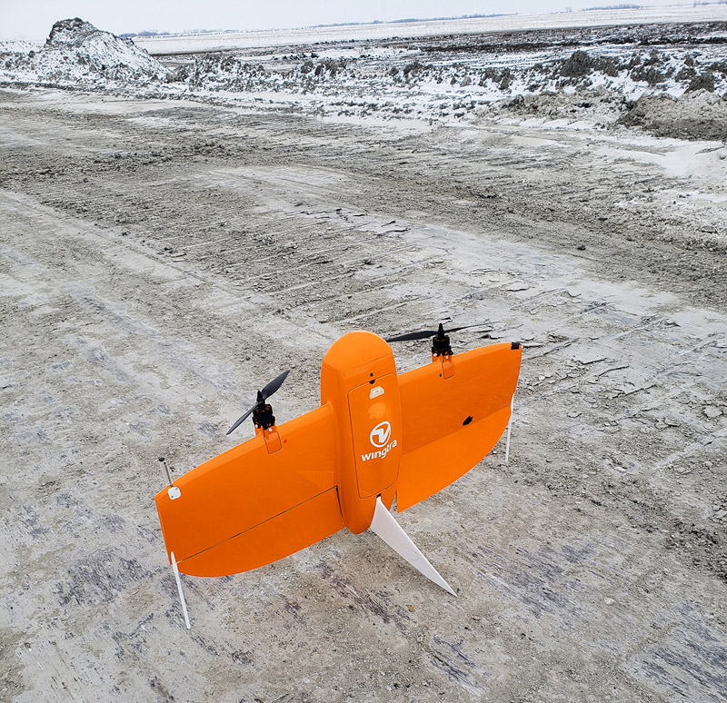
Westmoreland Mining LLC. is a 150 year-old energy firm with its roots in the coal fields of Pennsylvania. Over the years, its operations have grown to span North America, where it provides energy as well as creating jobs and enhancing communities.
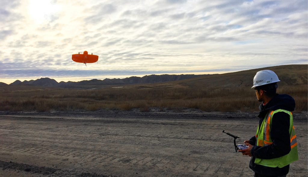
The company has evolved through the Civil War, the two World Wars and the Great Depression, surviving a transformed marketplace and political landscape. A big key to the company’s longevity has been its ability to adapt. So it’s no wonder that the firm was already exploring drone technology back in 2014. About a year and a half ago, it upgraded to WingtraOne to enhance safety and boost productivity of it’s mining operations.
Specifically, drone coal mine surveys help Westomoreland calculate stockpile volumes, road widths, dragline operations and the amount of reclamation they have done to meet sustainability goals.
“We’ve used other techniques, but by far drones are the most accurate, and with WingtraOne we can map an entire pit in less than an hour,” said Albert Wang, Engineering Co-op Student at Westmoreland. “When we did it manually, we’d spend four or five hours walking the entire pit. Now, it’s more accurate and takes about 30 minutes.”
3
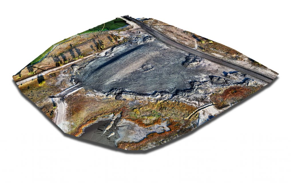
1. A WingtraOne stockpile image from an Estevan Mine pit. This output, based on rich data, is used to generate contours and calculate the volume of the stockpile.
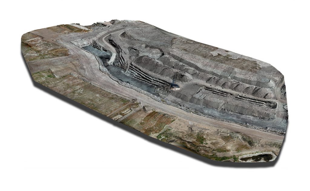
2. A WingtraOne data output of an Estevan Mine pit. This is used to see if the draglines are working to to design and to calculate how much dirt has been moved since the last flight. It is also used to design ramps down to the pits as part of a plan for reclamation of the dirt that has been moved. Most importantly it’s used to see if there are any conditions within the pit that could be dangerous or cause burial of coal (such high wall failures).
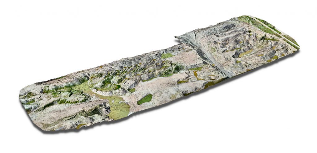
3. This WingtraOne drone data output offers rich data on an area of Estevan Mine that Westmoreland plans to reclaim. The output is used to design a reclaim surface that’s sent to the dozer operators in order to accurately restore the area to design.
How drone mining surveys optimize workflows
In Westmoreland’s massive Estevan coal mine complex, in Saskatchewan, Canada, drone pilots fly WingtraOne about three times a week to evaluate pits. They are especially keen to get stockpile volumetrics from mining drone data so that operations can run smoothly based on precise estimates of what needs to be moved and when.
“Surveyors used to use a GPS to manually record hundreds of data points,” Wang said. “But they couldn’t effectively survey the side slopes due to safety concerns. Now we can safely get millions of points with the drone in about 15 minutes vs. the two hours it used to take to do manually with a GPS. We save time and get a more precise value of the tons of coal we have.”
Each of the four pits at the Estevan complex takes about a half hour in total to fly with WingtraOne. The horizontal and vertical accuracy aim is between 2 and 4 cm (0.8 and 1.6 in). Wang said WingtraOne captures this consistently, enabling regular updates with high-quality map outputs. The drone-data-based coal mine maps are used by Westmoreland’s technical services department as well as SaskPower—the power company for Saskatchewan.
“This added level of accuracy also allows us to load the data into 3D modelling and design programs,” Wang said. “We then use it to create more accurate designs, which we send out to our GPS-guided equipment.”
Kurtis Popkie, Junior Mine Geologist at Westmoreland, is particularly impressed by the level of detail they get from the WingtraOne’s RX1R II camera.
“The amount of detail you can pick up from the orthomosaics is insane,” he said. “Way better than what we had before. It’s really good for safety as well. You can see what’s happening in detail while avoiding disruption of operations on a busy site, with all of its coordinated moving equipment.”

VTOL vs. fixed-wing on mine sites
Surveying in mining has risen in prominence over the past five years. It’s no longer surprising how much time, money and headaches they save. However, you can save even more depending on the type of drone you choose. In rough and rugged environments that require wide coverage, like mines, users are discovering that VTOL is the wisest investment.
“We were using a leading-brand classical fixed-wing before,” Wang said. “It wasn’t bad; it was passable. But it was so light it had trouble with high winds, and the camera wasn’t as good, and we didn’t have PPK so we had to spend time placing ground control around the pits.”
There’s also the issue of safety. In environments with so many moving parts and people, you need to predict where and how the drone is going to land within a couple of meters. This isn’t possible with fixed-wings, which require a large, soft area to land, for the sake of both payload and people.
“Because the drone we used before was a fixed-wing, it would belly land, which is like a crash landing,” Wang said. “This means a lot of wear and tear. And sometimes it would fly off and crash where we didn’t expect it to. With WingtraOne, we don’t need to worry about crash landing or obstacles—it’s very useful for us.”
“Setting a good example for the rest of the industry”
For Wang and Popkie, working with WingtraOne is like a dream. While people might fly drones as a hobby, they fly them as part of their mining surveyor jobs. And they get serious, helpful information for their teams with them. WingtraOne invites their excitement even more, since it’s powerful yet features a reliable and user-friendly workflow.
“How easy WingtraOne is to use really helps out especially if you have new students or employees,” Wang said. “It saves tons of time and it’s very easy to use.”
As budgets tighten and the world goes through more market changes and societal shifts, efficient technology emerges not only as attractive but necessary to keep up. And the easier it is to integrate it, the better.
“Adopting high-tech solutions like WingtraOne sets a good example for the rest of the industry, Wang said. “Especially in times like these—we need to be doing things better, and the cost savings is significant as well.”
Learn more about WingtraOne here.
Comments