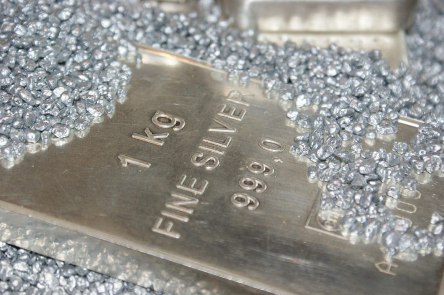
China’s big silver squeeze persists even as prices steady
Domestic producers and traders are struggling to fill a backlog of orders, pushing up near-term prices and leaving the market heavily backwardated.

HIGHLIGHTS
|
Field photographs from exploration programs at Bamboo (left) and Miralga (right)
Commenting on the latest exploration programs in the East Pilbara, Novo Executive Co-Chairman and Acting CEO Mike Spreadborough said “We are pleased to have reached an agreement with the Nyamal Aboriginal Corporation and thank them for their ongoing support of Novo and our exploration endeavours on their land. The terms of this agreement attest to the strong relationship Novo has with the Nyamal People.
Novo looks forward to advancing its exploration in the region, as we continue key activities across the priority Bamboo and Miralga Projects.”
_____________________________________
1 Refer to Appendix 1 for assay results.
VANCOUVER, British Columbia, Aug. 15, 2024 (GLOBE NEWSWIRE) -- Novo Resources Corp. (Novo or the Company) (ASX: NVO) (TSX: NVO) (OTCQX: NSRPF) is pleased to advise that a Determination Wide Aboriginal Heritage Protection Agreement (the Agreement) has been signed between Novo and the Nyamal Aboriginal Corporation (NAC). The execution of this Agreement streamlines the interactions between Novo and the Nyamal People and confirms Novo’s commitment to open, honest and transparent dealings with the Traditional Owners of the Pilbara Region.
The Agreement with NAC covers a large part of the East Pilbara District and allows Novo to conduct non ground disturbing surface works including mapping and surface geochemistry, specifically targeting the priority Bamboo and Miralga Projects. A cultural heritage site avoidance survey took place at Bamboo on 6 and 7 August 2024 to enable drill testing, with a final report expected later in the month.
The Agreement also provides for compensation payments for the benefit of the Traditional Owners which are customary and in line with normal commercial terms for similar agreements of this nature.
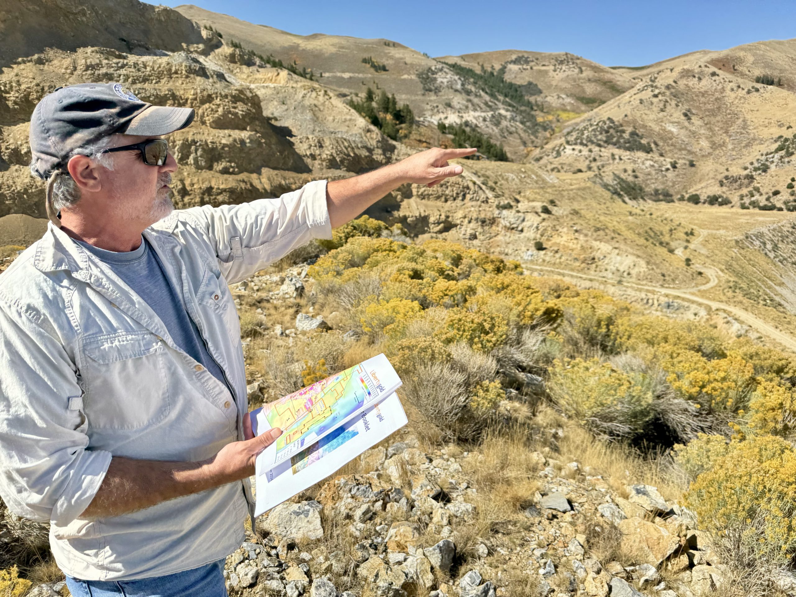
EAST PILBARA DISTRICT
The East Pilbara District encompasses Novo tenements around the townships of Marble Bar and Nullagine (Figure 1) and fall within the Nyamal and Palyku Native Title Determination areas.
Approximately 1,500 sq km of prospective and under explored tenure around Marble Bar is currently being advanced by mapping, geochemical surveys and geophysical/remote sensing interpretation. The large landholding comprises orogenic and intrusion-related gold targets, including porphyry / intermediate sulphidation epithermal-style targets at Gully Washer and Shady Camp West on the Miralga Project. A new target style now includes a series of sanukitoid-like intrusions which are evident along a major structural corridor trending along the Nullagine and Bamboo / Strattons projects. Unusual wire gold has been identified in proximity to one of these intrusions at Strattons.
Figure 1: East Pilbara District
Bamboo – Strattons
The Bamboo and Strattons Projects are located approximately 60 km east of Marble Bar. Regional exploration programs completed by Novo and previous explorers, have identified several gold anomalous zones within the Apex Basalt of the Warrawoona Group. The Apex Basalt is the host to orogenic gold prospects along strike, including the Bamboo Creek mining centre (Figure 2), where total historical production is estimated to be over 220,000 ounces at 8.7 g/t Au2.
Figure 2: Bamboo - Strattons Projects showing mapped or interpreted intrusion targets
The tenure contains a series of 1.77 Ga Bridget Suite intrusions as part of a 150 km north-northwest trend (Figure 2). Soil sampling completed by Novo has returned anomalous gold results in proximity to multiple intrusions some of which are emplaced into the otherwise unmineralised Upper Fortescue sequences, suggesting mineralisation is related to their emplacement. During field work – surface gold (Figure 3) was detected in the form of wire gold in proximity to one of these intrusions.
The Bridget Suite intrusions range in composition from hornblende monzogranite to quartz monzonite and associated hornblende porphyry dykes; and as such they postdate the Archean orogenic mineralisation events associated with gold deposits in the Mosquito Creek and Mallina Basins.
_____________________________________
2 Refer to the Calidus Resources Ltd (ASX: CAI) ASX news release dated 19 February 2024 available at www.asx.com.au. Novo has not conducted data verification (including as that term is defined in National Instrument 43-101 Standards of Disclosure for Mineral Projects) in respect of the data/information set out in that news release under the JORC Code 2012 or NI 43-101.
With the new Nyamal Agreement now in place, Novo intends to conduct detailed mapping and soil sampling over 2 km strike of the Apex Basalt and two Bridget Suite intrusions to identify drill targets for RC drill testing.
Figure 3: Photos of fine native gold with an unusual wire-like habit, found in proximity to an intrusion at Bamboo.
Cautionary Statement: Visual occurrence of surface gold cannot be taken as representative of bedrock mineralisation and no assaying of the occurrence has been undertaken. Visual estimates of mineral abundance should never be considered a proxy or substitute for laboratory analyses where concentrations or grades are the factor of principal economic interest. Visual estimates also potentially provide no information regarding impurities or deleterious physical properties relevant to valuations.
Miralga Project
The Miralga Project is located 30 km west of Marble Bar. The project is located on the eastern flank of the North Pole Dome where exploration in the 1970s and 1990s focussed on porphyry-style and epithermal vein-style mineralisation within the Panorama Formation. Known porphyry mineralisation is present outside of Novo’s tenure at Miralga Creek B (Figure 4), where Au-Ag-Cu mineralisation is associated with a stock-like Archaean porphyry, high-level dykes and epithermal veins.
Geophysical and remote sensing interpretation, coupled with review of existing geochemical datasets, identified several porphyry targets on Novo’s tenure where some targets have seen little to no historical exploration. Anomalies were defined using airborne magnetics and radiometric surveys (particularly potassium anomalies), sentinel and satellite imagery, along with normalising base metal geochemical data from the 1970s to 1990s. Porphyry and intrusion-related targets have now been defined over 25 km strike (Figure 4).
Three targets were investigated in the field, two of which require significant follow-up – Gully Washer and Shady Camp West.
Gully Washer is a precious and base-metal rich breccia and vein array related to a felsic porphyry stock which outcrops over 275 m and is up to 35 m width (Figure 5). Rock samples collected by Novo in 2021 returned peak results of 14.8 g/t Au, 10,083 g/t Ag (342 oz/t Ag), 3.8% Cu, 28.3% Pb and 3.6% Zn3 (results are not necessarily representative of mineralisation in the district).
High-grade mineralisation is located along the flanks of the gossanous porphyry and related to a maximum six-metre-wide zone of malachite-bearing breccia on both hangingwall and footwall positions of the intrusion (Figure 6). The footwall of the mineralised gossanous outcrop returned four > 2,000 g/t Ag rock chip samples along 100 m of strike, including one sample of over 1 % Ag.
_____________________________________
3 Refer to Appendix 1 for assay results.
Exploration by Novo has included a handheld Niton XRF soil grid and reconnaissance mapping which defined intense alteration zones overlapping a 1 km long NW trending Cu soil anomaly (Figure 5). The Gully Washer breccia is centered in the approximate middle of the broader Cu anomaly and alteration zone.
Immediately east of Gully Washer, stream sediment sampling has yielded a peak assay of 266 ppb Au in an area with distinct color anomalism on airborne imagery (Figure 5).
Figure 4: Miralga Project showing mapped or interpreted intrusion targets
Additional mapping, alteration studies, and surface soil and rock chip sampling is planned for Q3 2024 to better delineate high grade mineralisation defined to date, to close off existing soil anomalism, to follow-up the highly anomalous stream sediment sample and to understand the scope of the broader intrusion related target.
Figure 5: Gully Washer prospect map showing rock sample results.
Figure 6: Mineralised gossan on the southern porphyry margin looking east. Sample R00988 (taken at the position of the central front sample bag) returned assays of 4.6 ppm Au, 99 ppm Ag, and 1.4% Pb4.
_____________________________________
4 Refer to Appendix 1 for assay results
Shady Camp West was defined in the 1980s, with broad surface mapping, rock chip sampling and costeaning defining Cu-Au-(Mo) enriched porphyry and intense alteration of the porphyry and adjacent host basalt (AMAX Australia 1980, 1981). Information disclosed in annual exploration reports filed by AMAX Australia Limited in 19825 that are available on the Western Australian Department of Energy, Mines, Industry Regulation and Safety’s (“DEMIRS”) website (WAMEX Reports), indicate that best costean sampling results include 30 m @ 631 ppm Cu and 100 m @ 461 ppm Cu, with peak assays of 1,350 ppm Cu and 0.32 g/t Au in an altered and potentially leached porphyry. Rock chip results included maximum values of 1.3 g/t Au and 12.5% Cu associated with the northern and southern margins of the rhyodacite intrusive (AMAX Australia 1980, 1981). Information disclosed in the WAMEX Reports will assist Novo with exploration targeting.
Cautionary Statement: The exploration results contained in the WAMEX Reports have not been reported in accordance with the JORC Code or NI 43-101 and a Competent Person/Qualified Person has not done sufficient work to disclose the exploration results in accordance with the JORC Code 2012 or NI 43-101. It is possible that following further evaluation and/or exploration work that the confidence in the prior reported exploration results may be reduced when reported under the JORC Code 2012 or NI 43-101. Novo confirms that nothing has come to its attention that causes it to question the accuracy or reliability of the results included in the WAMEX Reports, but Novo has not independently validated those results and therefore is not to be regarded as reporting, adopting or endorsing those results. No assurance can be given that Novo will achieve similar results as part of its exploration activities at Shady Camp West.
Shady Camp West was prioritised by Novo for investigation due to a large radiometric potassium anomaly extending over 2.2 km north to south (Figure 7) and discrete magnetic lows and highs associated with an intense colour anomaly on airborne imagery.
Work undertaken by Novo includes rock chip sampling, grid pXRF soil sampling and reconnaissance mapping. Geological mapping identified a suite of felsic porphyries intruding mafic and intermediate volcanics. Intense alteration and associated weathering products include kaolinitic clay and limonite, with silicification around quartz vein stockworks.
Indicative results from handheld Niton XRF soil sampling on 160 m x 40 m spaced E-W lines highlighted a >100 ppm coherent Cu anomaly over 1.2 km long, and open to the north, coincident with potassium alteration, magnetic complexity and maximum quartz veining (Figure 7).
The pXRF readings are not verified by an independent laboratory and are not considered to be a proxy or substitute for laboratory analysis. A single orientation line of -80# soil samples which were analysed by an independent laboratory has defined a weak Au and Mo anomaly correlating with pXRF Cu anomalies, with peak results of 26 ppb Au, 3.7 ppm Mo, 100 ppm As, 250 ppm Cu and 130 ppm Zn6. Results may not be representative of mineralisation in the district.
Novo intends to conduct detailed alteration and vein mapping, soil sampling and follow-up ground geophysics if warranted, to generate multi-element geochemistry data and geophysical anomalies to determine whether porphyry style mineralisation exists. This program will be conducted over several weeks in Q3 2024.
_____________________________________
5 Refer to Amax Australia Limited 1982 Shady Camp Well Prospect Final Report – WAMEX Open File Data Report A11565.6 Refer to Appendix 1 for assay results.
Figure 7: Shady Camp West highlighting geophysical anomalies (left) and pXRF soil Cu geochemical anomalies (right). The potassic anomaly over 2.2 km strike partially overlaps with intense clay alteration of porphyries and host basalt (light colouration on the imagery). Coherent Cu anomalism is open and untested to the north and correlates with maximum quartz veining and weak Au and Mo anomalism in soils.
ANALYTIC METHODOLOGY
Rock chip samples of 1 – 3 kg were submitted to Intertek commercial Genalysis (“Intertek”) in Perth, Western Australia where they were dried and crushed to -3 mm and pulverized to 75 µm or better (prep code SP64), with a > 85% pass, then assayed for Au by 50 g charge fire assay FA50/OE and for 48 elements using four acid digest – MS finish (4A/MS). Elements that reported above the upper detection limit for 4A/MS were reanalysed using method 4AH/OE. A minimum of 2 CRM standards relevant for the style of mineralisation and 2 blanks were submitted per 100 samples.
Soil samples were sieved to < 80 mesh and submitted to Intertek for aqua regia to analyse for 33 elements. A minimum of 2 CRM standards, 2 blanks and 4 field duplicates were submitted per 100 samples.
Stream sediment samples were sieved to < 0.9 mm and submitted to Intertek where they were dried and pulverized to 75 µm or better (prep code SP02), with a > 85% pass, then analysed for aqua regia for 33 elements. In addition, the samples are analysed via BLEG (Bulk Leach Extractable Gold) 500 g cyanide leach with MS finish for Au, Pt, Pd and Ag.
pXRF readings of soils and rock chips were taken using a Niton XLT5 model and were used to aid field interpretation and identification of anomalous target mineralogy and pathfinder elements. The Niton pXRF instrument was calibrated daily and checked against reference material four times per 100 samples and at the start and end of each day.
The Niton pXRF uses an x-ray fluorescence tube to take an immediate reading over a small surface area. It is used to obtain an indicative value of certain elements to assist with exploration targeting. The pXRF readings are not verified by an independent laboratory, are not considered to be a proxy or substitute for laboratory analysis. Results may not be representative of mineralisation in the district.
Except as otherwise noted in this news release, there were no limitations to the verification process and all relevant data was verified by a qualified person/competent person (as defined in National Instrument 43-101 Standards of Disclosure for Mineral Projects (NI 43-101) and the Australasian Code for Reporting of Exploration Results, Mineral Resources and Ore Reserves (JORC 2012, Appendix 2) respectively), by reviewing QAQC performance of inserted reference material and the analytical procedures undertaken by Intertek.
Authorised for release by the Board of Directors.
CONTACT
| Investors:Mike Spreadborough +61 8 6400 6100 [email protected] | North American Queries:Leo Karabelas+1 416 543 [email protected] | Media:Cameron Gilenko+61 466 984 [email protected] |
QP STATEMENT
Mrs Karen (Kas) De Luca (MAIG), is the qualified person, as defined under NI 43-101 Standards of Disclosure for Mineral Projects, responsible for, and having reviewed and approved, the technical information contained in this news release. Mrs De Luca is Novo’s General Manager Exploration.
JORC COMPLIANCE STATEMENT
The information in this report that relates to exploration results in the East Pilbara District is based on information compiled by Mrs De Luca, who is a full-time employee of Novo Resources Corp. Mrs De Luca is a Competent Person who is a member of the Australian Institute of Geoscientists. Mrs De Luca has sufficient experience that is relevant to the style of mineralisation and the type of deposits under consideration and to the activity being undertaken to qualify as a Competent Person as defined in the 2012 Edition of the 'Australasian Code for Reporting of Exploration Results, Mineral Resources and Ore Reserves'. Mrs De Luca consents to the inclusion in the report of the matters based on her information in the form and context in which it appears.
FORWARD-LOOKING STATEMENTS
Some statements in this news release may contain “forward-looking statements” within the meaning of Canadian and Australian securities law and regulations. In this news release, such statements include but are not limited to planned exploration activities and the timing of such. These statements address future events and conditions and, as such, involve known and unknown risks, uncertainties and other factors which may cause the actual results, performance or achievements to be materially different from any future results, performance or achievements expressed or implied by the statements. Such factors include, without limitation, customary risks of the resource industry and the risk factors identified in Novo’s annual information form for the year ended December 31, 2023 (which is available under Novo’s profile on SEDAR+ at www.sedarplus.ca and at www.asx.com.au) in the Company’s prospectus dated 2 August 2023 which is available at www.asx.com.au. Forward-looking statements speak only as of the date those statements are made. Except as required by applicable law, Novo assumes no obligation to update or to publicly announce the results of any change to any forward-looking statement contained or incorporated by reference herein to reflect actual results, future events or developments, changes in assumptions or changes in other factors affecting the forward-looking statements. If Novo updates any forward-looking statement(s), no inference should be drawn that the Company will make additional updates with respect to those or other forward-looking statements.
ABOUT NOVO
Novo is an Australian based gold explorer listed on the ASX and the TSX focused on discovering standalone gold projects with > 1 Moz development potential. Novo is an innovative gold explorer with a significant land package covering approximately 6,700 square kilometres in the Pilbara region of Western Australia, along with the 22 square kilometre Belltopper project in the Bendigo Tectonic Zone of Victoria, Australia.
Novo’s key project area is the Egina Gold Camp, where De Grey Mining (ASX: DEG) is farming-in to form a JV at the Becher Project and surrounding tenements through exploration expenditure of A$25 million within 4 years for a 50% interest. The Becher Project has similar geological characteristics as De Grey’s 12.7 Moz Hemi Project1. Novo is also advancing gold exploration at Nunyerry North, part of the Croydon JV (Novo 70%: Creasy Group 30%), where 2023 exploration drilling identified significant gold mineralisation. Novo continues to undertake early-stage exploration across its Pilbara tenement portfolio.
Novo has also formed lithium joint ventures with both Liatam and SQM in the Pilbara which provides shareholder exposure to battery metals.
Novo has a significant investment portfolio and a disciplined program in place to identify value accretive opportunities that will build further value for shareholders.
Please refer to Novo’s website for further information including the latest Corporate Presentation.
Appendix 1
Surface sample results for the Miralga Project, listing elements relevant to this mineralisation style(All sample locations are GPS located on MGA_2020 zone 50.)
| Sample ID | Type | Prospect | Au (ppm) | Ag (ppm) | Cu (ppm) | Pb (ppm) | Zn (ppm) | Sb (ppm) | Easting | Northing |
| NX1361301 | Rock Chip | Gully Washer | 14.81 | 64 | 3,588 | 10,965 | 36,416 | 1,161 | 757,548 | 7,665,836 |
| NX1361302 | Rock Chip | Gully Washer | 1.18 | 125 | 1,692 | 64,918 | 5,504 | 118 | 757,537 | 7,665,839 |
| NX1361303 | Rock Chip | Gully Washer | 0.08 | 2 | 86 | 461 | 611 | 11 | 757,564 | 7,665,985 |
| NX1361304 | Rock Chip | Gully Washer | 0.01 | 3 | 124 | 768 | 365 | 11 | 757,523 | 7,665,895 |
| NX1361305 | Rock Chip | Gully Washer | 0.01 | 2 | 117 | 70 | 120 | 12 | 757,522 | 7,665,884 |
| NX1361306 | Rock Chip | Gully Washer | 0.03 | 4 | 159 | 129 | 968 | 12 | 757,520 | 7,665,843 |
| NX1361307 | Rock Chip | Gully Washer | 2.34 | 40 | 3,464 | 9,508 | 10,334 | 352 | 757,522 | 7,665,839 |
| NX1361308 | Rock Chip | Gully Washer | 0.13 | 19 | 366 | 9,870 | 23,730 | 45 | 757,600 | 7,665,876 |
| NX1361309 | Rock Chip | Gully Washer | 0.02 | 1 | 32 | 203 | 423 | 15 | 757,606 | 7,665,885 |
| NX1361311 | Rock Chip | Gully Washer | 0.07 | 131 | 575 | 596 | 11,812 | 62 | 757,635 | 7,665,874 |
| NX1361312 | Rock Chip | Gully Washer | 3.60 | 2,130 | 14,857 | 9,008 | 1,258 | 1,123 | 757,635 | 7,665,878 |
| NX1361313 | Rock Chip | Gully Washer | 4.02 | 2,409 | 37,718 | 10,857 | 2,241 | 1,474 | 757,636 | 7,665,880 |
| NX1361314 | Rock Chip | Gully Washer | 6.07 | 2,013 | 33,529 | 5,138 | 4,970 | 2,480 | 757,638 | 7,665,882 |
| NX1361315 | Rock Chip | Gully Washer | 0.64 | 173 | 1,659 | 1,995 | 2,437 | 248 | 757,637 | 7,665,884 |
| NX1361316 | Rock Chip | Gully Washer | 0.48 | 34 | 376 | 1,714 | 6,389 | 30 | 757,657 | 7,665,881 |
| NX1361317 | Rock Chip | Gully Washer | 2.36 | 88 | 1,517 | 5,158 | 8,653 | 285 | 757,662 | 7,665,881 |
| NX1361318 | Rock Chip | Gully Washer | 4.23 | 177 | 5,691 | 14,239 | 10,653 | 1,384 | 757,676 | 7,665,878 |
| NX1361319 | Rock Chip | Gully Washer | 0.05 | 188 | 350 | 6,439 | 702 | 71 | 757,706 | 7,665,879 |
| NX1361320 | Rock Chip | Gully Washer | 0.04 | 51 | 103 | 2,083 | 1,839 | 79 | 757,703 | 7,665,877 |
| NX1361321 | Rock Chip | Gully Washer | 0.26 | 28 | 850 | 2,651 | 5,314 | 151 | 757,699 | 7,665,876 |
| NX1361322 | Rock Chip | Gully Washer | 0.01 | 3 | 37 | 235 | 489 | 14 | 757,720 | 7,665,877 |
| NX1361325 | Rock Chip | Gully Washer | 2.85 | 10,083 | 334 | 283,103 | 287 | 1,774 | 757,726 | 7,665,861 |
| NX1361326 | Rock Chip | Gully Washer | 0.74 | 48 | 220 | 4,525 | 554 | 138 | 757,756 | 7,665,859 |
| NX1361327 | Rock Chip | Gully Washer | 0.30 | 130 | 501 | 2,863 | 1,827 | 413 | 757,667 | 7,665,849 |
| NX1361328 | Rock Chip | Gully Washer | 0.04 | 12 | 454 | 6,575 | 5,159 | 12 | 757,468 | 7,665,887 |
| NX1361329 | Rock Chip | Gully Washer | 0.01 | 3 | 122 | 138 | 181 | 7 | 757,484 | 7,665,888 |
| R00986 | Rock Chip | Gully Washer | 0.64 | 22 | 827 | 13,110 | 2,035 | 45 | 757,633 | 7,665,852 |
| R00987 | Rock Chip | Gully Washer | 0.03 | 7 | 444 | 1,745 | 2,649 | 10 | 757,630 | 7,665,847 |
| R00988 | Rock Chip | Gully Washer | 4.55 | 99 | 325 | 14,262 | 538 | 481 | 757,625 | 7,665,850 |
| R00989 | Rock Chip | Gully Washer | 0.24 | 20 | 102 | 3,012 | 122 | 81 | 757,626 | 7,665,851 |
| R00990 | Rock Chip | Gully Washer | 0.13 | 10 | 451 | 3,383 | 6,745 | 81 | 757,610 | 7,665,851 |
| R00991 | Rock Chip | Gully Washer | 0.03 | 5 | 172 | 1,783 | 3,002 | 15 | 757,607 | 7,665,852 |
| R00992 | Rock Chip | Gully Washer | 1.96 | 10 | 549 | 2,786 | 3,868 | 155 | 757,608 | 7,665,855 |
| R00993 | Rock Chip | Gully Washer | 0.07 | 9 | 150 | 754 | 1,631 | 22 | 757,594 | 7,665,853 |
| R00994 | Rock Chip | Gully Washer | 0.05 | 14 | 111 | 431 | 1,370 | 42 | 757,594 | 7,665,851 |
| R00995 | Rock Chip | Gully Washer | 0.05 | 14 | 168 | 1,906 | 4,004 | 40 | 757,594 | 7,665,851 |
| R00996 | Rock Chip | Gully Washer | 0.05 | 7 | 238 | 2,421 | 3,974 | 26 | 757,596 | 7,665,846 |
| R00997 | Rock Chip | Gully Washer | 0.35 | 51 | 303 | 3,789 | 1,918 | 406 | 757,584 | 7,665,839 |
| R00998 | Rock Chip | Gully Washer | 0.06 | 30 | 60 | 6,225 | 255 | 92 | 757,581 | 7,665,843 |
| R00999 | Rock Chip | Gully Washer | 0.09 | 19 | 70 | 1,516 | 349 | 43 | 757,561 | 7,665,838 |
| R01000 | Rock Chip | Gully Washer | 0.87 | 96 | 186 | 3,413 | 432 | 658 | 757,559 | 7,665,837 |
| Sample ID | Type | Project | Au (ppb) | Ag (ppm) | Cu (ppm) | Pb (ppm) | Zn (ppm) | Mo (ppm) | Easting | Northing |
| NVO-16206 | Stream | Miralga | 2.0 | 0.05 | 65 | 7 | 70 | 0.3 | 764,097 | 7,662,491 |
| NVO-16207 | Stream | Miralga | 0.5 | 0.03 | 54 | 5 | 53 | 0.4 | 764,115 | 7,662,484 |
| NVO-16208 | Stream | Miralga | 2.0 | 0.06 | 73 | 7 | 84 | 0.7 | 764,154 | 7,662,359 |
| NVO-16209 | Stream | Miralga | 2.0 | 0.03 | 72 | 6 | 79 | 0.5 | 764,254 | 7,662,245 |
| NVO-16210 | Stream | Miralga | 2.0 | 0.03 | 69 | 5 | 82 | 0.5 | 764,259 | 7,662,234 |
| NVO-16224 | Stream | Miralga | 1.0 | 0.03 | 59 | 6 | 66 | 0.3 | 764,071 | 7,662,120 |
| NVO-16225 | Stream | Miralga | 1.0 | 0.03 | 70 | 5 | 88 | 0.5 | 764,094 | 7,662,104 |
| NVO-16226 | Stream | Miralga | 1.0 | 0.03 | 84 | 5 | 95 | 0.5 | 764,262 | 7,661,635 |
| NVO-16227 | Stream | Miralga | 1.0 | 0.03 | 70 | 6 | 87 | 0.3 | 764,234 | 7,661,276 |
| NVO-16228 | Stream | Miralga | 1.0 | 0.03 | 67 | 5 | 77 | 0.4 | 764,252 | 7,661,274 |
| NVO-16229 | Stream | Miralga | 0.5 | 0.06 | 55 | 12 | 74 | 0.7 | 764,379 | 7,661,143 |
| NVO-16230 | Stream | Miralga | 1.0 | 0.03 | 51 | 6 | 67 | 0.6 | 764,911 | 7,662,250 |
| NVO-16231 | Stream | Miralga | 2.0 | 0.03 | 46 | 6 | 67 | 0.6 | 764,995 | 7,662,439 |
| NVO-16232 | Stream | Miralga | 1.0 | 0.03 | 72 | 6 | 113 | 0.5 | 764,811 | 7,662,748 |
| NVO-16233 | Stream | Miralga | 0.5 | 0.03 | 60 | 6 | 92 | 0.5 | 764,798 | 7,662,770 |
| NVO-16234 | Stream | Miralga | 2.0 | 0.03 | 51 | 5 | 76 | 0.4 | 765,342 | 7,662,705 |
| NVO-16235 | Stream | Miralga | 2.0 | 0.03 | 70 | 5 | 80 | 0.4 | 765,363 | 7,662,585 |
| NVO-16236 | Stream | Miralga | 1.0 | 0.03 | 73 | 6 | 71 | 0.5 | 765,408 | 7,662,391 |
| NVO-16237 | Stream | Miralga | 0.5 | 0.03 | 102 | 13 | 101 | 0.5 | 765,419 | 7,662,052 |
| NVO-16238 | Stream | Miralga | 0.7 | 0.03 | 65 | 10 | 69 | 0.5 | 765,375 | 7,662,044 |
| NVO-16240 | Stream | Miralga | 1.0 | 0.03 | 66 | 6 | 85 | 0.7 | 765,198 | 7,662,795 |
| NVO-16241 | Stream | Miralga | 0.5 | 0.03 | 12 | 4 | 24 | 0.4 | 765,300 | 7,661,905 |
| NVO-16242 | Stream | Miralga | 0.5 | 0.03 | 19 | 4 | 42 | 0.5 | 765,161 | 7,661,801 |
| NVO-16243 | Stream | Miralga | 0.5 | 0.03 | 32 | 7 | 45 | 0.5 | 764,990 | 7,661,305 |
| NVO-16244 | Stream | Miralga | 0.5 | 0.03 | 47 | 9 | 63 | 0.7 | 764,854 | 7,661,227 |
| NVO-16246 | Stream | Miralga | 1.0 | 0.03 | 65 | 6 | 68 | 0.6 | 764,595 | 7,661,315 |
| NVO-16247 | Stream | Miralga | 0.5 | 0.03 | 129 | 4 | 101 | 0.3 | 759,709 | 7,661,134 |
| NVO-16248 | Stream | Miralga | 0.5 | 0.03 | 122 | 4 | 98 | 0.3 | 759,703 | 7,661,120 |
| NVO-16249 | Stream | Miralga | 688.4 | 0.03 | 118 | 6 | 72 | 0.3 | 759,571 | 7,661,257 |
| NVO-16250 | Stream | Miralga | 0.5 | 0.03 | 130 | 4 | 98 | 0.3 | 759,558 | 7,661,247 |
| NVO-16276 | Stream | Miralga | 0.5 | 0.03 | 119 | 6 | 114 | 0.3 | 759,438 | 7,661,238 |
| NVO-16277 | Stream | Miralga | 2.0 | 0.09 | 67 | 25 | 108 | 0.6 | 759,627 | 7,661,535 |
| NVO-16278 | Stream | Miralga | 2.0 | 0.05 | 73 | 29 | 128 | 0.4 | 759,631 | 7,661,516 |
| NVO-16279 | Stream | Miralga | 0.5 | 0.03 | 65 | 7 | 76 | 0.4 | 759,841 | 7,662,980 |
| NVO-16280 | Stream | Miralga | 1.0 | 0.05 | 61 | 7 | 81 | 0.4 | 759,704 | 7,662,924 |
| NVO-16281 | Stream | Miralga | 0.5 | 0.06 | 89 | 11 | 91 | 0.6 | 759,543 | 7,662,915 |
| NVO-16282 | Stream | Miralga | 0.5 | 0.03 | 50 | 9 | 129 | 0.4 | 759,554 | 7,662,891 |
| NVO-16283 | Stream | Miralga | 0.5 | 0.03 | 32 | 7 | 46 | 0.5 | 759,517 | 7,662,816 |
| NVO-16284 | Stream | Miralga | 0.5 | 0.03 | 65 | 8 | 72 | 0.5 | 759,599 | 7,663,809 |
| NVO-16286 | Stream | Miralga | 0.5 | 0.03 | 53 | 7 | 61 | 0.6 | 759,609 | 7,663,813 |
| NVO-16287 | Stream | Miralga | 0.5 | 0.03 | 25 | 9 | 58 | 0.7 | 759,520 | 7,663,530 |
| NVO-16288 | Stream | Miralga | 0.5 | 0.07 | 22 | 15 | 63 | 0.8 | 759,505 | 7,663,533 |
| NVO-16289 | Stream | Miralga | 0.5 | 0.06 | 64 | 11 | 94 | 0.4 | 759,108 | 7,662,227 |
| NVO-16290 | Stream | Miralga | 0.5 | 0.08 | 131 | 9 | 79 | 0.6 | 759,261 | 7,662,463 |
| NVO-16291 | Stream | Miralga | 0.5 | 0.03 | 67 | 20 | 136 | 1.0 | 758,070 | 7,663,986 |
| NVO-16292 | Stream | Miralga | 0.5 | 0.03 | 13 | 7 | 38 | 0.5 | 758,354 | 7,664,405 |
| NVO-16293 | Stream | Miralga | 0.5 | 0.06 | 86 | 26 | 107 | 0.6 | 758,352 | 7,664,332 |
| NVO-16294 | Stream | Miralga | 0.5 | 0.03 | 40 | 13 | 50 | 0.5 | 758,381 | 7,664,305 |
| NVO-16296 | Stream | Miralga | 0.5 | 0.03 | 58 | 15 | 128 | 0.4 | 758,455 | 7,664,248 |
| NVO-16297 | Stream | Miralga | 2.0 | 0.03 | 42 | 23 | 102 | 0.5 | 758,469 | 7,663,862 |
| NVO-16298 | Stream | Miralga | 0.5 | 0.08 | 91 | 25 | 163 | 0.9 | 758,271 | 7,663,688 |
| NVO-16299 | Stream | Miralga | 0.5 | 0.10 | 102 | 9 | 146 | 0.7 | 758,182 | 7,663,624 |
| NVO-16354 | Stream | Miralga | 0.5 | 0.13 | 17 | 62 | 77 | 0.5 | 758,411 | 7,664,874 |
| NVO-16355 | Stream | Miralga | 0.5 | 0.03 | 16 | 6 | 37 | 0.4 | 758,152 | 7,665,077 |
| NVO-16356 | Stream | Miralga | 0.5 | 0.03 | 21 | 7 | 48 | 0.6 | 758,083 | 7,665,062 |
| NVO-16357 | Stream | Miralga | 1.0 | 0.17 | 58 | 36 | 121 | 0.9 | 758,177 | 7,665,521 |
| NVO-16358 | Stream | Miralga | 12.0 | 1.12 | 64 | 128 | 153 | 0.8 | 758,197 | 7,665,623 |
| NVO-16359 | Stream | Miralga | 1.0 | 0.03 | 28 | 12 | 81 | 0.9 | 758,429 | 7,665,634 |
| NVO-16360 | Stream | Miralga | 0.5 | 0.03 | 15 | 9 | 69 | 0.7 | 758,417 | 7,665,636 |
| NVO-16361 | Stream | Miralga | 266.3 | 0.26 | 52 | 48 | 107 | 0.8 | 758,237 | 7,665,789 |
| NVO-16362 | Stream | Miralga | 0.8 | 0.08 | 108 | 14 | 131 | 0.6 | 756,641 | 7,667,321 |
| NVO-16363 | Stream | Miralga | 1.0 | 0.15 | 62 | 33 | 136 | 0.5 | 756,586 | 7,667,275 |
| NVO-16364 | Stream | Miralga | 0.5 | 0.16 | 89 | 23 | 154 | 0.5 | 757,129 | 7,666,582 |
| NVO-16366 | Stream | Miralga | 1.0 | 0.12 | 88 | 17 | 125 | 0.6 | 757,609 | 7,667,072 |
| NVO-16367 | Stream | Miralga | 0.5 | 0.15 | 147 | 17 | 131 | 0.7 | 757,636 | 7,667,066 |
| NVO-16368 | Stream | Miralga | 0.5 | 0.09 | 142 | 11 | 101 | 0.4 | 757,815 | 7,667,122 |
| NVO-16369 | Stream | Miralga | 1.0 | 0.16 | 130 | 18 | 116 | 0.6 | 757,847 | 7,667,106 |
| NVO-16371 | Stream | Miralga | 1.0 | 0.16 | 123 | 24 | 123 | 0.7 | 758,263 | 7,666,822 |
| NVO-16372 | Stream | Miralga | 2.0 | 0.16 | 132 | 19 | 133 | 0.6 | 758,265 | 7,666,831 |
| NVO-16373 | Stream | Miralga | 0.5 | 0.13 | 117 | 14 | 138 | 0.7 | 758,145 | 7,666,476 |
| NVO-16374 | Stream | Miralga | 2.0 | 0.06 | 102 | 10 | 118 | 0.7 | 758,142 | 7,666,465 |
| NVO-16375 | Stream | Miralga | 0.5 | 0.13 | 94 | 13 | 133 | 0.6 | 757,852 | 7,666,683 |
| NVO-16376 | Stream | Miralga | 0.6 | 0.15 | 74 | 18 | 118 | 0.6 | 757,843 | 7,666,674 |
| NVO-16377 | Stream | Miralga | 0.7 | 0.08 | 100 | 15 | 112 | 0.4 | 759,292 | 7,666,945 |
| NVO-16378 | Stream | Miralga | 0.6 | 0.11 | 114 | 18 | 132 | 0.5 | 759,329 | 7,666,908 |
| NVO-16379 | Stream | Miralga | 0.5 | 0.07 | 81 | 21 | 95 | 0.4 | 759,345 | 7,666,907 |
| NVO-16380 | Stream | Miralga | 1.0 | 0.11 | 81 | 13 | 107 | 0.4 | 759,106 | 7,666,677 |
| NVO-16381 | Stream | Miralga | 0.8 | 0.10 | 195 | 20 | 155 | 0.7 | 759,090 | 7,666,700 |
| NVO-16382 | Stream | Miralga | 0.5 | 0.03 | 28 | 7 | 38 | 0.6 | 761,662 | 7,655,617 |
| NVO-16383 | Stream | Miralga | 2.0 | 0.03 | 56 | 5 | 70 | 0.3 | 762,188 | 7,655,318 |
| NVO-16384 | Stream | Miralga | 1.0 | 0.03 | 67 | 7 | 86 | 0.3 | 762,173 | 7,655,332 |
| NVO-16386 | Stream | Miralga | 0.5 | 0.03 | 81 | 6 | 77 | 0.4 | 762,272 | 7,654,725 |
| NVO-16387 | Stream | Miralga | 1.0 | 0.03 | 64 | 6 | 82 | 0.3 | 761,875 | 7,654,682 |
| NVO-16388 | Stream | Miralga | 0.5 | 0.03 | 54 | 6 | 73 | 0.5 | 761,909 | 7,654,734 |
| NVO-16389 | Stream | Miralga | 0.5 | 0.03 | 39 | 6 | 57 | 0.5 | 761,529 | 7,655,175 |
| NVO-16390 | Stream | Miralga | 0.5 | 0.03 | 66 | 5 | 73 | 0.4 | 761,509 | 7,655,178 |
| NVO-16391 | Stream | Miralga | 0.5 | 0.03 | 46 | 6 | 61 | 0.5 | 761,519 | 7,655,247 |
| NVO-16392 | Stream | Miralga | 0.5 | 0.03 | 65 | 5 | 104 | 0.5 | 759,997 | 7,656,120 |
| NVO-16393 | Stream | Miralga | 0.5 | 0.06 | 92 | 8 | 128 | 0.5 | 759,955 | 7,655,795 |
| NVO-16394 | Stream | Miralga | 1.0 | 0.03 | 77 | 4 | 123 | 0.4 | 759,924 | 7,655,782 |
| NVO-16396 | Stream | Miralga | 0.5 | 0.08 | 85 | 7 | 107 | 0.5 | 760,264 | 7,655,541 |
| NVO-16397 | Stream | Miralga | 0.5 | 0.03 | 83 | 4 | 123 | 0.4 | 760,613 | 7,655,338 |
| NVO-16398 | Stream | Miralga | 0.5 | 0.03 | 95 | 9 | 107 | 0.7 | 760,612 | 7,655,366 |
| NVO-16399 | Stream | Miralga | 0.5 | 0.06 | 113 | 6 | 114 | 0.5 | 760,816 | 7,655,348 |
| NVO-16400 | Stream | Miralga | 0.5 | 0.06 | 86 | 12 | 98 | 0.4 | 761,162 | 7,655,284 |
| NVO-16511 | Stream | Miralga | 0.5 | 0.03 | 60 | 6 | 100 | 0.4 | 760,648 | 7,657,239 |
| NVO-16512 | Stream | Miralga | 2.0 | 0.08 | 58 | 8 | 110 | 0.4 | 760,634 | 7,657,240 |
| NVO-16513 | Stream | Miralga | 0.8 | 0.05 | 61 | 7 | 99 | 0.4 | 760,488 | 7,657,194 |
| NVO-16514 | Stream | Miralga | 0.5 | 0.03 | 36 | 10 | 66 | 0.5 | 760,563 | 7,656,936 |
| NVO-16515 | Stream | Miralga | 2.0 | 0.03 | 70 | 6 | 111 | 0.4 | 760,689 | 7,656,784 |
| NVO-16516 | Stream | Miralga | 0.5 | 0.03 | 41 | 5 | 74 | 0.4 | 760,696 | 7,656,803 |
| Sample ID | Type | Project | Au (ppb) | As (ppm) | Cu (ppm) | Pb (ppm) | Zn (ppm) | Mo (ppm) | Easting MGA 2020 Z50 | Northing MGA 2020 Z50 |
| H9594 | Soil | Shady Camp West | 1.0 | 4 | 60 | 10 | 57 | 0.6 | 761,199 | 7,656,279 |
| H9595 | Soil | Shady Camp West | 1.0 | 3 | 47 | 8 | 52 | 0.7 | 761,239 | 7,656,279 |
| H9596 | Soil | Shady Camp West | 1.0 | 5 | 31 | 10 | 39 | 0.5 | 761,279 | 7,656,278 |
| H9631 | Soil | Shady Camp West | 0.5 | 3 | 164 | 6 | 39 | 0.4 | 761,479 | 7,656,279 |
| H9632 | Soil | Shady Camp West | 2.0 | 3 | 109 | 8 | 52 | 0.6 | 761,519 | 7,656,279 |
| H9633 | Soil | Shady Camp West | 0.5 | 3 | 79 | 8 | 64 | 0.5 | 761,559 | 7,656,279 |
| H9640 | Soil | Shady Camp West | 5.0 | 3 | 32 | 28 | 16 | 0.6 | 761,799 | 7,656,278 |
| H9641 | Soil | Shady Camp West | 12.0 | 100 | 83 | 17 | 36 | 3.7 | 761,838 | 7,656,278 |
| H9642 | Soil | Shady Camp West | 4.0 | 16 | 94 | 21 | 130 | 0.9 | 761,879 | 7,656,279 |
| H9643 | Soil | Shady Camp West | 1.0 | 5 | 39 | 8 | 74 | 0.6 | 761,920 | 7,656,279 |
| H9644 | Soil | Shady Camp West | 1.0 | 4 | 50 | 9 | 50 | 0.8 | 761,960 | 7,656,278 |
| H9597 | Soil | Shady Camp West | 1.0 | 6 | 73 | 17 | 44 | 0.9 | 761,320 | 7,656,279 |
| H9598 | Soil | Shady Camp West | 2.0 | 3 | 52 | 9 | 52 | 0.5 | 761,359 | 7,656,278 |
| H9599 | Soil | Shady Camp West | 2.0 | 3 | 59 | 8 | 49 | 0.5 | 761,399 | 7,656,278 |
| H9630 | Soil | Shady Camp West | 1.0 | 4 | 100 | 9 | 44 | 0.7 | 761,439 | 7,656,279 |
| H9634 | Soil | Shady Camp West | 0.5 | 3 | 54 | 8 | 41 | 0.5 | 761,599 | 7,656,279 |
| H9636 | Soil | Shady Camp West | 26.0 | 4 | 250 | 20 | 32 | 0.5 | 761,648 | 7,656,278 |
| H9637 | Soil | Shady Camp West | 13.0 | 4 | 107 | 22 | 27 | 0.4 | 761,679 | 7,656,278 |
| H9638 | Soil | Shady Camp West | 7.0 | 4 | 71 | 15 | 19 | 1.1 | 761,720 | 7,656,279 |
| H9639 | Soil | Shady Camp West | 11.0 | 5 | 105 | 22 | 26 | 1.0 | 761,759 | 7,656,278 |
| H9646 | Soil | Shady Camp West | 2.0 | 4 | 67 | 9 | 75 | 0.7 | 761,999 | 7,656,278 |
| H9647 | Soil | Shady Camp West | 0.5 | 3 | 40 | 24 | 71 | 0.5 | 762,040 | 7,656,279 |
| H9648 | Soil | Shady Camp West | 5.0 | 5 | 61 | 51 | 112 | 0.8 | 762,079 | 7,656,279 |
Visual wire gold observations (Bamboo)
(All sample locations are GPS located on MGA_2020 zone 50.)
| Sample ID | Type | Project | Mineral observed | Visual estimate (%) | Description mineral size (mm) | Easting | Northing |
| N/A | Detected | Bamboo | Native Gold | N/A | Wire gold | 220,735 | 7,673,280 |
Appendix 2 - JORC Code, 2012 Edition – Table 1
Section 1: Sampling Techniques and Data
(Criteria listed in the preceding section also apply to this section.)
| Criteria | JORC Code explanation | Commentary |
| Sampling techniques |
|
|
| Drilling techniques |
|
|
| Drill sample recovery |
|
|
| Logging |
|
|
| Sub-sampling techniques and sample preparation |
|
|
| Quality of assay data and laboratory tests |
|
|
| Verification of sampling and assaying |
|
|
| Location of data points |
|
|
| Data spacing and distribution |
|
|
| Orientation of data in relation to geological structure |
|
|
| Sample security |
|
|
| Audits or reviews |
|
|
Section 2: Reporting of Exploration Results
(Criteria listed in the preceding section also apply to this section.)
| Criteria | JORC Code explanation | Commentary |
| Mineral tenement and land tenure status |
|
|
| Exploration done by other parties |
|
|
| Geology |
|
|
| Drill hole Information |
|
|
| Data aggregation methods |
|
|
| Relationship between mineralisation widths and intercept lengths |
|
|
| Diagrams |
|
|
| Balanced reporting |
|
|
| Other substantive exploration data |
|
|
| Further work |
|
|
No Section 3 or 4 report as no Mineral Resources or Ore Reserves are reported in this Appendix
Photos and charts accompanying this announcement are available at
https://www.globenewswire.com/NewsRoom/AttachmentNg/dbf1b3bd-d23b-4ccd-9371-f3501998b247
https://www.globenewswire.com/NewsRoom/AttachmentNg/f5e41ab5-3c97-4968-86fc-93eb00049295
https://www.globenewswire.com/NewsRoom/AttachmentNg/58cc4f17-ca65-41dc-ac96-3a0a5251a446
https://www.globenewswire.com/NewsRoom/AttachmentNg/4af41664-e366-4578-8ad0-e3046cab57cc
https://www.globenewswire.com/NewsRoom/AttachmentNg/7b749f5f-4539-4f30-b3dd-8f1edd89af8c
https://www.globenewswire.com/NewsRoom/AttachmentNg/961c5e62-1ce7-479e-9f7f-acb36055972d
https://www.globenewswire.com/NewsRoom/AttachmentNg/a700a0ec-8e9e-41e2-a34f-be25b4bd3786
https://www.globenewswire.com/NewsRoom/AttachmentNg/dcc3ed88-c7e1-48a4-b3e2-b7319bb9ba88
https://www.globenewswire.com/NewsRoom/AttachmentNg/fc64e1a4-5575-4a39-9b44-f33774aa174d


The new Mining Power Rankings are live. Vote for the sector’s leaders in each of the Large-, Small-, and Micro-Cap leagues.