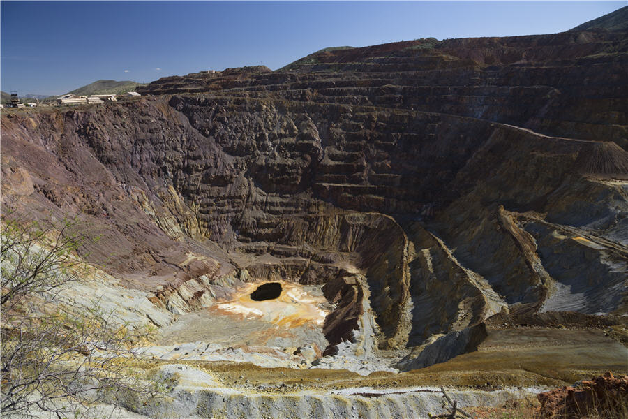
Goldman expects wave of South Africa deals fueled by commodities
“We are in the late stage of a commodity boom, with gold spiking and platinum prices rebounding strongly," Goldman's Simon Denny says.

[email protected]www.fissionuranium.com
TSX SYMBOL: FCUOTCQX SYMBOL: FCUUF FRANKFURT SYMBOL: 2FU
100% hit rate for nineteen-hole program on the R1515W zone
KELOWNA, BC, July 17, 2024 /CNW/ - FISSION URANIUM CORP. ("Fission" or "the Company") is pleased to announce results from the final thirteen drill holes on the R1515W zone at its PLS property, in Canada's Athabasca Basin region. All holes intercepted wide intervals of mineralization, with nine holes additionally hitting high-grade sections. Of particular note, PLS24-664 (line 1545W) intersected 6.74m of total composite >10,000 cps in 77.0m of total composite mineralization and PLS24-663 (line 1500W) intersected 5.79m of total composite >10,000 cps in 50.4m of total composite mineralization. The R1515W upgrade program is now complete. Results will be used to upgrade the resource classification of the zone from mostly inferred to indicated and higher, for potential inclusion in the current mine plan (see News Release April 08, 2024).
Ross McElroy, President and CEO for Fission, commented, "Our resource growth program has been a resounding success. Every hole is strongly mineralized with the majority intersecting high-grade intervals. With these results in hand, and once assay results quantify and qualify results, we are confident we will have achieved our goal of upgrading the majority of the R1515W zone resource classification. After which, once upgraded, we will be able to consider including the zone in the mine plan in the future. This in turn will increase mine reserves and further enhance the production profile of the PLS project."
Drilling Highlights
Table 1: Drill Hole Summary
Hole ID | Zone | Collar | Hand-held Scintillometer Results On Mineralized Drillcore (>300 cps / >0.5m minimum) | Basement Unconformity Depth (m) | Total Drillhole Depth (m) | |||||
Grid Line | Az | Dip | From (m) | To (m) | Width (m) | CPS Peak Range | ||||
PLS24-660 | R1515W | 1560W | 337 | -66.9 | 126.0 | 126.5 | 0.5 | 300 | 117.5 | 365.4 |
134.5 | 140.0 | 5.5 | <300 - 480 | |||||||
181.0 | 188.0 | 7.0 | <300 - 660 | |||||||
199.5 | 203.5 | 4.0 | 300 - 27500 | |||||||
206.0 | 207.0 | 1.0 | 390 - 400 | |||||||
212.5 | 216.5 | 4.0 | <300 - 1000 | |||||||
229.5 | 240.0 | 10.5 | <300 - 15000 | |||||||
244.0 | 246.0 | 2.0 | <300 - 320 | |||||||
258.0 | 261.5 | 3.5 | 470 - 1000 | |||||||
281.5 | 282.0 | 0.5 | 710 | |||||||
300.5 | 303.5 | 3.0 | 460 - 2900 | |||||||
PLS24-662 | R1515W | 1515W | 336 | -65.1 | 204.5 | 208.0 | 3.5 | 330 - 1100 | 124.2 | 359.0 |
250.0 | 252.5 | 2.5 | 340 - 15700 | |||||||
257.5 | 273.5 | 16.0 | <300 - 9300 | |||||||
276.5 | 285.5 | 9.0 | <300 - 44800 | |||||||
288.5 | 289.5 | 1.0 | 460 - 1200 | |||||||
296.0 | 298.5 | 2.5 | <300 - 1000 | |||||||
309.0 | 309.5 | 0.5 | 760 | |||||||
PLS24-663 | R1515W | 1500W | 336 | -65.4 | 117.0 | 117.4 | 0.3 | 320 | 113.6 | 281.0 |
122.5 | 127.0 | 4.5 | <300 - 430 | |||||||
130.0 | 134.0 | 4.0 | <300 - 7100 | |||||||
154.0 | 195.5 | 41.5 | <300 - >65535 | |||||||
PLS24-664 | R1515W | 1545W | 336 | -65.7 | 131.0 | 131.5 | 0.5 | 300 | 115.5 | 332.0 |
156.5 | 157.5 | 1.0 | 510 - 670 | |||||||
164.0 | 199.5 | 35.5 | <300 - 52400 | |||||||
218.0 | 220.5 | 2.5 | <300 - 540 | |||||||
230.0 | 236.5 | 6.5 | <300 - 18900 | |||||||
242.0 | 243.0 | 1.0 | 300 - 320 | |||||||
248.5 | 261.0 | 12.5 | <300 - >65535 | |||||||
263.5 | 272.5 | 9.0 | <300 - >65535 | |||||||
275.5 | 284.0 | 8.5 | <300 - 6100 | |||||||
PLS24-665 | R1515W | 1530W | 336 | -66.1 | 120.0 | 120.5 | 0.5 | 380 | 117.9 | 345.0 |
124.5 | 131.5 | 7.0 | <300 - 800 | |||||||
134.5 | 135.5 | 1.0 | 380 | |||||||
179.0 | 194.0 | 15.0 | <300 - 3600 | |||||||
198.5 | 201.5 | 3.0 | <300 - 520 | |||||||
211.0 | 215.0 | 4.0 | <300 - 1500 | |||||||
234.5 | 239.0 | 4.5 | <300 - 25500 | |||||||
241.5 | 242.5 | 1.0 | 570 - 810 | |||||||
246.5 | 247.0 | 0.5 | 540 | |||||||
249.5 | 262.5 | 13.0 | <300 - 21100 | |||||||
265.0 | 265.5 | 0.5 | 750 | |||||||
278.0 | 289.0 | 11.0 | <300 - 1600 | |||||||
PLS24-666 | R1515W | 1500W | 335 | -65.3 | 115.1 | 116.7 | 1.7 | 470 - 2000 | 115.0 | 278.0 |
123.0 | 123.5 | 0.5 | 350 | |||||||
149.0 | 152.0 | 3.0 | 310 - 620 | |||||||
168.5 | 169.0 | 0.5 | 400 | |||||||
171.5 | 172.0 | 0.5 | 380 | |||||||
190.0 | 191.0 | 1.0 | 340 - 430 | |||||||
PLS24-668 | R1515W | 1500W | 336 | -64.9 | 136.5 | 138.5 | 2.0 | <300 - 1400 | 115.3 | 278.0 |
147.5 | 151.0 | 3.5 | <300 - 610 | |||||||
160.5 | 188.5 | 28.0 | <300 - 18300 | |||||||
214.0 | 220.5 | 6.5 | <300 - 1500 | |||||||
225.0 | 225.5 | 0.5 | 360 | |||||||
PLS24-669 | R1515W | 1530W | 338 | -65.3 | 152.0 | 152.5 | 0.5 | 390 | 118.9 | 377.0 |
163.0 | 163.5 | 0.5 | 300 | |||||||
214.5 | 216.0 | 1.5 | 1300 - 8400 | |||||||
231.0 | 233.5 | 2.5 | <300 - 550 | |||||||
243.5 | 245.0 | 1.5 | 530 - 900 | |||||||
250.0 | 254.0 | 4.0 | 310 - 960 | |||||||
259.5 | 261.5 | 2.0 | 440 - 1300 | |||||||
269.5 | 290.5 | 21.0 | <300 - 28500 | |||||||
296.0 | 296.5 | 0.5 | 2300 | |||||||
309.5 | 310.5 | 1.0 | 630 - 1100 | |||||||
PLS24-671 | R1515W | 1560W | 336 | -62.2 | 132.0 | 132.5 | 0.5 | 300 | 126.5 | 323.0 |
145.0 | 145.5 | 0.5 | 300 | |||||||
169.0 | 193.5 | 24.5 | <300 - 5900 | |||||||
210.0 | 211.5 | 1.5 | 440 - 610 | |||||||
238.5 | 247.5 | 9.0 | <300 - 5500 | |||||||
250.0 | 253.5 | 3.5 | 500 - 28200 | |||||||
PLS24-673 | R1515W | 1560W | 336 | -78.0 | 172.0 | 173.0 | 1.0 | 370 | 105.2 | 284.0 |
180.0 | 196.5 | 16.5 | <300 - 48800 | |||||||
215.0 | 215.5 | 0.5 | 310 | |||||||
PLS24-675 | R1515W | 1515W | 337 | -64.7 | 119.0 | 121.0 | 2.0 | 300 - 400 | 117.1 | 304.3 |
126.0 | 126.5 | 0.5 | 560 | |||||||
156.0 | 162.5 | 6.5 | 300 - 2500 | |||||||
184.0 | 193.5 | 9.5 | <300 - 1800 | |||||||
210.0 | 242.0 | 32.0 | <300 - 6200 | |||||||
PLS24-676 | R1515W | 1545W | 337 | -75.0 | 177.5 | 178.5 | 1.0 | 350 - 500 | 106.1 | 293.0 |
184.0 | 184.5 | 0.5 | 340 | |||||||
190.0 | 194.0 | 4.0 | <300 - 710 | |||||||
206.5 | 246.5 | 40.0 | <300 - 7000 | |||||||
249.0 | 249.5 | 0.5 | 790 | |||||||
PLS24-677 | R1515W | 1530W | 335 | -81.0 | 178.0 | 178.5 | 0.5 | 500 | 104.5 | 290.0 |
188.5 | 194.5 | 6.0 | <300 - 400 | |||||||
203.5 | 211.5 | 8.0 | <300 - 5300 | |||||||
214.5 | 230.5 | 16.0 | <300 - 7100 | |||||||
Drilling: Technical Details for the R1515W Zone and the 19-Hole Program
The R1515W zone presently contains an Indicated Resource of 67,000 tonnes at an average grade of 1.15% U3O8 totaling 1.7 million lb. U3O8 and an Inferred Resource of 234,000 tonnes at an average grade of 0.96% U3O8 totaling 5 million lb. U3O8, using a cutoff grade of 0.25% U3O8. The objective of R1515W drilling was to convert areas of the R1515W zone currently classified as Inferred Resources to Indicated Resources through closely spaced drilling, potentially allowing it to be brought into the current mine plan. Drillhole pierce point spacing at the R1515W zone to upgrade the resource classification targeted ~25m by ~15m, grid north-south by grid east-west, respectively. Additionally, critical geotechnical and hydrogeological information will be collected at the R1515W zone, to be used in the assessment of viability of inclusion in the overall PLS project mine plan and schedule.
Line 1500WThree additional drillholes, PLS24-663, 666 and 668 have been completed on gridline 1500W in 2024, aiming to confirm modeled uranium mineralization in the east-most area of the R1515W zone. PLS24-663 intersected bedrock at a depth of 113.6m, consisting of a 1.5m thin lens of Devonian sandstone underlain by strongly altered orthogneiss to a depth of 197.8m and finally quartz-feldspar gneiss to a final depth of 281.0m. A total of 50.4m of total composite radioactivity >300 counts per second (cps) on handheld scintillometer were intersected in four zones, including a total of 5.79m >10,000 cps. PLS24-666 was drilled up-dip of PLS24-663 and intersected bedrock at a depth of 115.0m, consisting of strongly altered orthogneiss to 175.1m and footwall quartz-feldspar gneiss to the end of the drillhole at 278.0m. A total of 7.2m of composite radioactivity >300 cps was interested in six zones. PLS24-668 was drilled down-dip of PLS24-663 and intersected bedrock at a depth of 115.3m, consisting of silicified hanging wall to 143.0m, strongly altered orthogneiss to 220.4m and finally quartz-feldspar gneiss footwall to a final depth of 278.0m. A total of 40.5m of total composite radioactivity >300 cps was intersected in five zones, including 0.25m of >10,000 cps radioactivity. The radioactivity cored in PLS24-663 represents the strongest radioactivity seen on grid line 1500W to date and is open to the east.
Line 1515WTwo additional drillholes, PLS24-662 and 675 have been completed on grid line 1515W in 2024, aiming to confirm modeled uranium mineralization in the eastern R1515W. PLS24-662 intersected bedrock at a depth of 124.2m downhole which consisted of a silicified hanging wall underlain by strongly altered orthogneiss and graphitic mylonite and finally footwall quartz-feldspar gneiss, the latter of which continued to a final depth of 359.0m. Thirty-five meters of total composite radioactivity >300 cps on handheld scintillometer were intersected in seven zones between 204.5m and 309.5m, including 0.59m of total composite radioactivity >10,000 cps. PLS24-675 was drilled up-dip of PLS24-652 and intersected bedrock at a depth of 117.1m, consisting of moderate to strongly altered sequence of orthogneisses and quartz-feldspar gneiss, followed by footwall quartz-feldspar gneiss to a final depth of 340.3m. A total of 50.5m of composite radioactivity >300 cps was intersected in five zones between 119.0m to 242.0m. Radioactivity remains open grid-south of PLS24-662.
Line 1530WThree additional drillholes, PLS24-665, 669 and 677 were completed on line 1530W in 2024, targeting modeled uranium mineralization in the central R1515W zone. PLS24-665 intersected bedrock at a depth of 117.9m and consisted of strongly altered orthogneiss and mylonite followed by variably clay, chlorite and hematite altered footwall quartz-feldspar gneiss to the end of the drillhole at a depth of 345.0m. A total of 61.0m of total composite radioactivity >300 cps was intersected in five zones between 120.0m and 289.0m, including 1.5m > 10,000 cps. PLS24-669 intersected bedrock at a depth of 118.9m and consisted of strongly altered orthogneiss and mylonite followed by variably clay, chlorite and hematite altered footwall quartz-feldspar gneiss to the end of the drillhole at a depth of 377.0m. A total of 35.0m of total composite radioactivity >300 cps was intersected in five zones between 152.0m and 310.5m, including 0.82m > 10,000 cps. PLS24-677 intersected bedrock at a depth of 104.5m and consisted of strongly altered orthogneiss and quartz-feldspar gneiss followed by variably clay, chlorite and hematite altered footwall quartz-feldspar gneiss to the end of the drillhole at a depth of 290.0m. A total of 30.5m of total composite radioactivity >300 cps was intersected in four zones between 178.0m and 230.5m. The radioactivity intersected in PLS24-677 remains open to the grid-north.
Line 1545WTwo additional drillholes, PLS24-664 and 676 were completed on line 1545W in 2024, aiming to confirm line-central and footwall uranium mineralization modeling, respectively. PLS24-664 intersected bedrock at a depth of 115.5m which consisted of the typical sequence of strongly altered orthogneiss intercalated with mylonite, followed by footwall quartz-feldspar gneiss to a final depth of 332.0m. PLS24-664 intersected a total of 77.0m of total composite radioactivity >300 cps in nine zones between 131.0m and 284.0m, including 6.74m >10,000 cps and 1.0m >65,535 cps. PLS24-676 intersected bedrock at a depth of 106.1m, which consisted of intensely altered orthogneiss intercalated with coarse grained quartz-feldspar gneiss followed by footwall quartz-feldspar gneiss to a final depth of 293.0m. The drillhole intersected 46.0m of total composite radioactivity >300 cps in five zones between 177.5m to 249.5m.
Line 1560WThree additional drillholes, PLS24-660, 671 and 673 were completed on line 1560W in 2024, aiming to confirm line-central and footwall uranium mineralization modeling at the western end of R1515W. PLS24-660 intersected bedrock at a depth of 117.5m which consisted of strongly altered orthogneiss and mylonite to 288.2m followed by variably altered footwall quartz-feldspar gneiss to a final depth of 365.4m. Forty-four meters of total composite radioactivity >300 cps was intersected between 126.0m to 303.5m in twelve zones, including 1.07m of total composite radioactivity >10,000 cps. PLS24-671 intersected bedrock at a depth of 126.5m which consisted of a silicified hanging wall to 198.6m, strongly altered orthogneiss and mylonite to 257.4m followed by variably altered footwall quartz-feldspar gneiss to a final depth of 323.0m. A total of 39.5m of composite radioactivity >300 cps was intersected between 132.0m to 253.5m in six zones, including 0.75m of total composite radioactivity >10,000 cps. PLS24-673 intersected bedrock at a depth of 105.2m which consisted of strongly altered orthogneiss and mylonite to 192.5m followed by variably altered footwall quartz-feldspar gneiss to a final depth of 284.0m. Eighteen meters of total composite radioactivity >300 cps was intersected between 172.0m to 215.5m in three zones, including 2.0m of total composite radioactivity >10,000 cps. The radioactivity intersected in PLS24-673 remains open to the grid-north.
Natural gamma radiation in drill core that is reported in this news release was measured in counts per second (cps) using a hand-held RS-125 Scintillometer manufactured by Radiation Solutions, which is capable of discriminating readings up to 65,535 cps. Drill holes are systematically down-hole surveyed for natural gamma radiation, measured in counts per second (cps) using a Mount Sopris 2GHF-1000 Triple Gamma probe, which allows for accurate measurements in high grade mineralized zones. The reader is cautioned that scintillometer readings are not directly or uniformly related to uranium grades of the rock sample measured, and should be used only as a preliminary indication of the presence of radioactive materials. The degree of radioactivity within the mineralized intervals is highly variable and associated with visible pitchblende mineralization. All intersections are down-hole. All depths reported of core interval measurements including radioactivity and mineralization intervals widths are not always representative of true thickness. The orientation of the mineralized intervals tend to follow that of lithologic contacts, and generally dip steeply to the south. Within the Triple R deposit, individual zone wireframe models constructed from assay data and used in the resource estimate indicate that all five zones have a complex geometry controlled by and parallel to steeply south-dipping lithological boundaries as well as a preferential sub-horizontal orientation.
Samples from the drill core will be split in half sections on site and where possible, samples will be standardized at 0.5m down-hole intervals. One-half of the split sample will be sent to SRC Geoanalytical Laboratories (an SCC ISO/IEC 17025: 2005 Accredited Facility) in Saskatoon, SK for analysis which includes U3O8 (wt %) and fire assay for gold, while the other half remains on site for reference. All analysis includes a 63 element ICP-OES, uranium by fluorimetry and boron.
PLS Mineralized Trend & Triple R Deposit Summary
Uranium mineralization at the Triple R deposit at PLS occurs within the Patterson Lake Conductive Corridor and has been traced by core drilling over ~3.18km of east-west strike length in five separated mineralized "zones", which collectively make up the Triple R deposit. From west to east, these zones are R1515W, R840W, R00E, R780E and R1620E. Through successful exploration programs completed to date, Triple R has evolved into a large, near-surface, basement-hosted, structurally controlled high-grade uranium deposit. The discovery hole was announced on November 05, 2012, with drill hole PLS12-022 from what is now referred to as the R00E zone.
The R1515W, R840W and R00E zones make up the western region of the Triple R deposit and are located on land, where overburden thickness is generally between 55m to 100 m. R1515W is the westernmost of the zones and is drill defined to ~90m in strike length, ~68m across strike and ~220m vertical and where mineralization remains open in several directions. R840W is located ~515m to the east along the strike of R1515W and has a drill-defined strike length of ~430m. R00E is located ~485m to the east along strike of R840W and is drill defined to ~115m in strike length. The R780E and R1620E zones make up the eastern region of the Triple R deposit. Both zones are located beneath Patterson Lake, where water depth is generally less than six metres, and overburden thickness is generally about 50m. R780E is located ~225m to the east of R00E and has a drill-defined strike length of ~945m. R1620E is located ~210m along strike to the east of R780E and is drill defined to ~185m in strike length.
Mineralization along the Patterson Lake Corridor trend remains prospective along strike in both the western and eastern directions. Basement rocks within the mineralized trend are identified primarily as mafic rocks with varying degrees of alteration. Mineralization is both located within and associated with mafic rocks with varying degrees of silicification, metasomatic mineral assemblages and hydrothermal graphite. The graphitic sequences are associated with the PL-3B basement Electro-Magnetic (EM) conductor.
Patterson Lake South Property
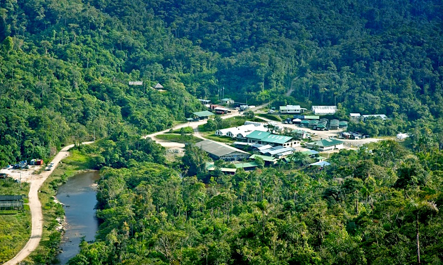
The 31,039-hectare PLS project is 100% owned and operated by Fission Uranium Corp. PLS is accessible by road with primary access from all-weather Highway 955, which runs north to the former Cluff Lake mine.
Qualified Persons
The technical information in this news release has been prepared in accordance with the Canadian regulatory requirements set out in National Instrument 43-101 and reviewed on behalf of the company by Ross McElroy, P.Geo., President and CEO for Fission Uranium Corp., a qualified person.
About Fission Uranium Corp.
Fission Uranium Corp. is an award-winning Canadian uranium project developer and 100% owner of the Patterson Lake South uranium property – a proposed high-grade uranium mine and mill in Canada's Athabasca Basin region. Fission's common shares are listed on the TSX Exchange under the symbol "FCU" and trade on the OTCQX marketplace in the U.S. under the symbol "FCUUF" and on the Frankfurt Stock Exchange under the symbol 2FU.
ON BEHALF OF THE BOARD
"Ross McElroy"
Ross McElroy, President and CEO
Cautionary Statement:
Certain information contained in this press release constitutes "forward-looking information", within the meaning of Canadian legislation. Generally, these forward-looking statements can be identified by the use of forward-looking terminology such as "plans", "expects" or "does not expect", "is expected", "budget", "scheduled", "estimates", "forecasts", "intends", "anticipates" or "does not anticipate", or "believes", or variations of such words and phrases or state that certain actions, events or results "may", "could", "would", "might" or "will be taken", "occur", "be achieved" or "has the potential to". Forward looking statements contained in this press release may include statements regarding the future operating or financial performance of the Company which involve known and unknown risks and uncertainties which may not prove to be accurate. Actual results and outcomes may differ materially from what is expressed or forecasted in these forward-looking statements. Such statements are qualified in their entirety by the inherent risks and uncertainties surrounding future expectations. Among those factors which could cause actual results to differ materially are the following: market conditions and other risk factors listed from time to time in our reports filed with Canadian securities regulators on SEDAR+ at www.sedarplus.ca. The forward-looking statements included in this press release are made as of the date of this press release and the Company disclaims any intention or obligation to update or revise any forward-looking statements, whether as a result of new information, future events or otherwise, except as expressly required by applicable securities legislation.
SOURCE Fission Uranium Corp.
View original content to download multimedia: http://www.newswire.ca/en/releases/archive/July2024/17/c7492.html


The new Mining Power Rankings are live. Vote for the sector’s leaders in each of the Large-, Small-, and Micro-Cap leagues.