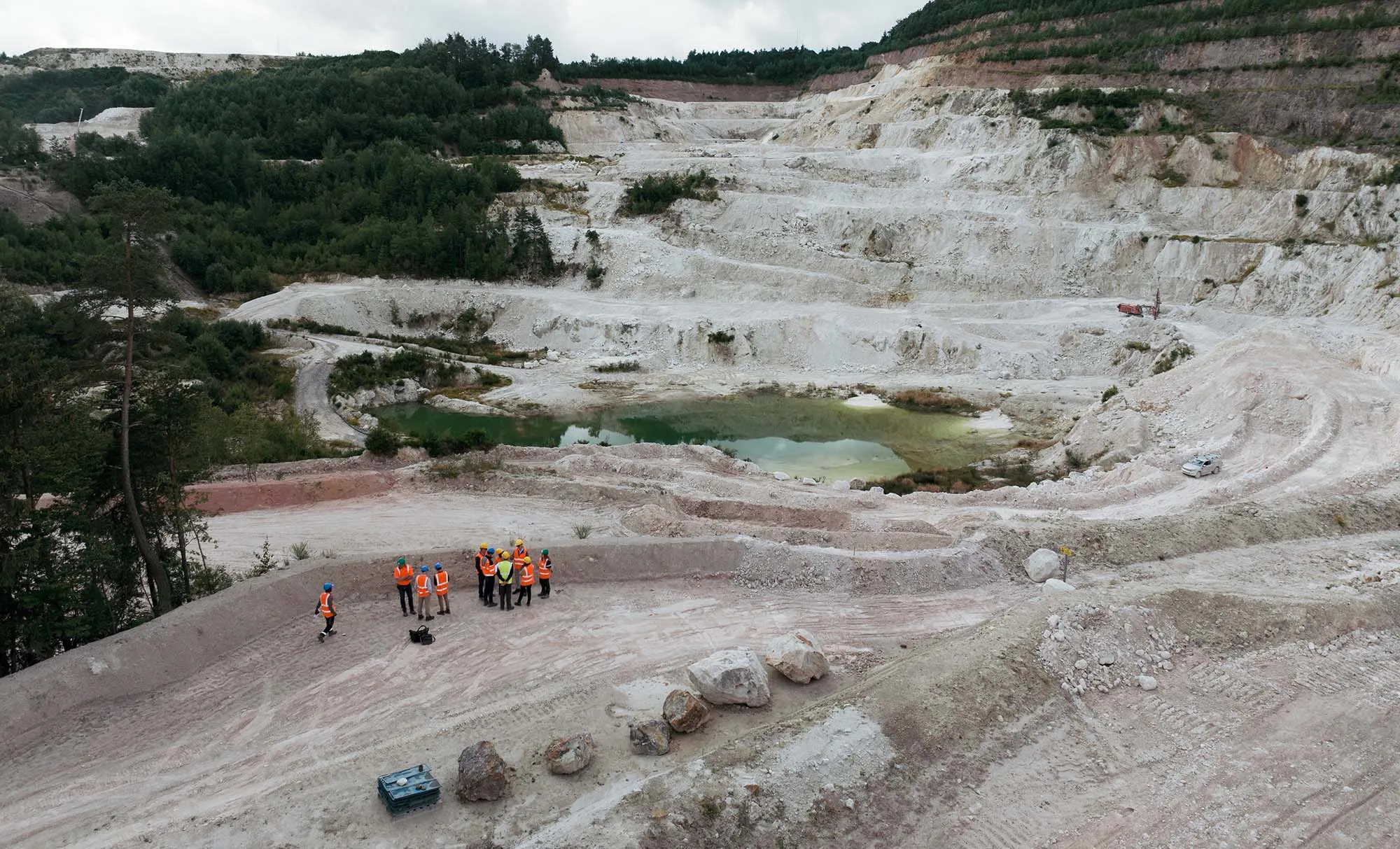
Geosoft gains Esri Gold Tier status

Geosoft has achieved Gold Tier status within the Esri Partner Network. The relationship  recognizes Geosoft’s commitment and collaboration with Esri to deliver integrated software solutions for the global mining and geosciences sector that optimize the use of data for discovery success.

Working effectively within GIS, and sharing multidisciplinary data and knowledge, are important requirements for geoscientists . Since 2003, Geosoft has been developing advanced earth mapping workflows for ArcGIS to increase productivity and targeting effectiveness within exploration programs and earth science investigations. Geosoft’s Target for ArcGIS extension software has become an industry standard for 3D visualization of drillhole geology within ArcGIS.

“Building on our longstanding relationship, we’re pleased to recognize Geosoft’s new status as an Esri Gold Tier Partner, “ said Geoff Wade, Natural Resource Industries Leader for Esri. “Our global relationship  and combined strengths have resulted in GIS solutions that are helping to solve complex exploration challenges within resource industries. “

“We’ve worked closely with Esri to develop solutions that help explorers gain greater insight from their data, and collaborate more effectively within an integrated environment,”  said Steve Randall, Geosoft Product Director. “The business, technical and support benefits gained through our Gold Tier status will allow us to continually enhance workflows and enrich capabilities for geoscientists exploring within Esri.”

The Esri Partner Network is a worldwide community of companies that develop and deliver cutting-edge geospatial solutions and services based on Esri technology. Together, Esri and its partners collaborate to support end users through successful GIS implementations and repeatable solutions. Esri Gold Tier Partners are a select group, representing the top few percent of the more than 2,200 partners in Esri’s Partner Network.

About Geosoft – www.geosoft.com

Since 1986, Geosoft has helped earth explorers make discoveries through data. Geosoft technology is industry-standard for mapping and modelling the Earth’s subsurface, and for managing large geoscience data. With offices across five continents, and a network of international business partners, Geosoft serves thousands of clients within exploration industries, government and the earth sciences, including the most successful oil and mineral explorers in the world. Geosoft has been ranked as a Top 250 Technology Company, and one of the Ten Best Workplaces in Canada.

About Esri – www.esri.com

Since 1969, Esri has been giving customers around the world the power to think and plan geographically. The market leader in geographic information system (GIS) technology, Esri software is used in more than 300,000 organizations worldwide including each of the 200 largest cities in the United States, most national governments, more than two-thirds of Fortune 500 companies, and more than 7,000 colleges and universities. Esri applications, running on more than one million desktops and thousands of Web and enterprise servers, provide the backbone for the world’s mapping and spatial analysis. Esri is the only vendor that provides complete technical solutions for desktop, mobile, server, and Internet platforms. Visit us at esri.com/news.