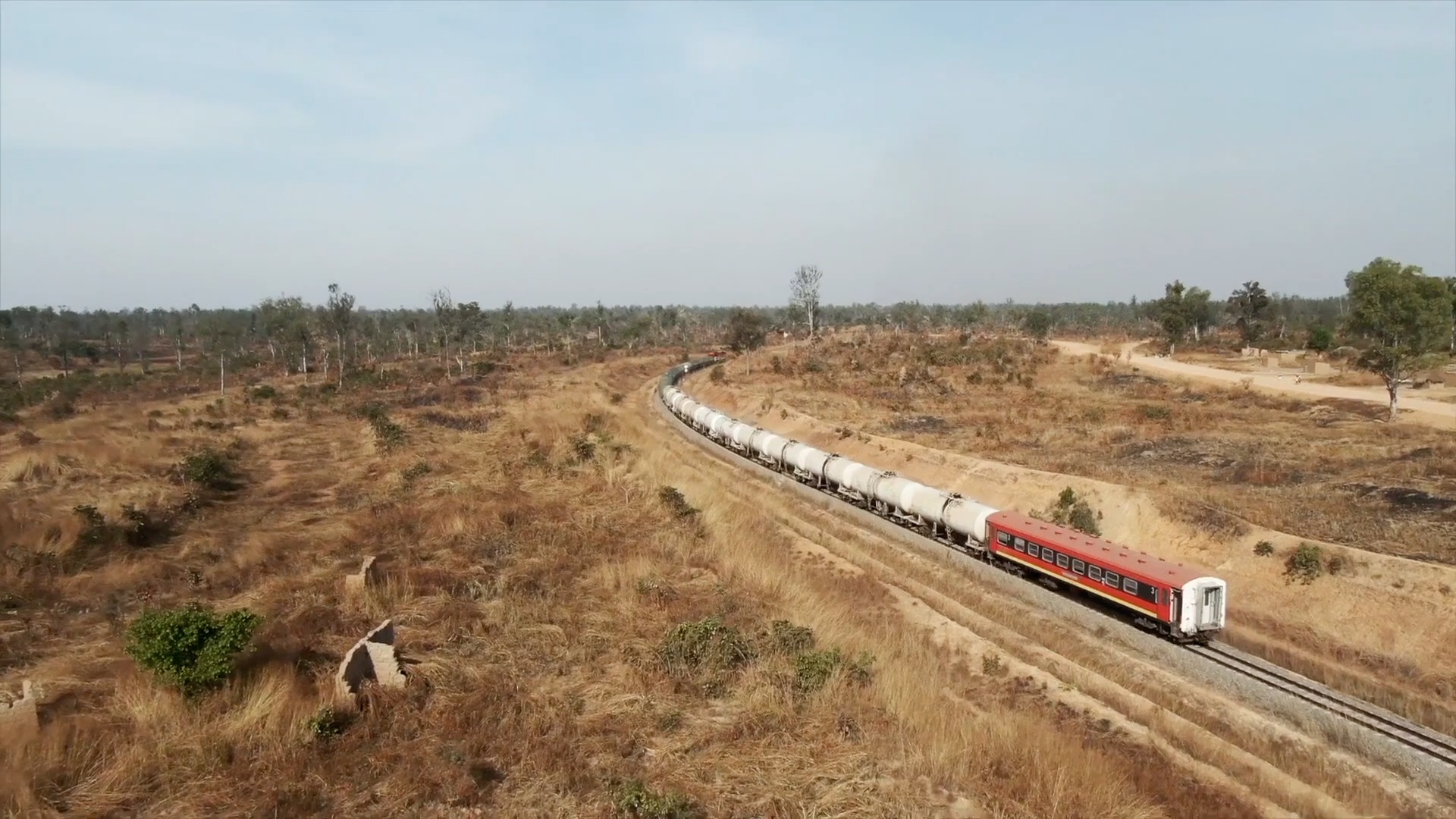
Global refined copper surplus swells in first half of 2024 — report
New data from the ICSG indicated a preliminary surplus of about 488,000 tonnes, which is significantly higher than the 115,000 tonnes for H1 2023.
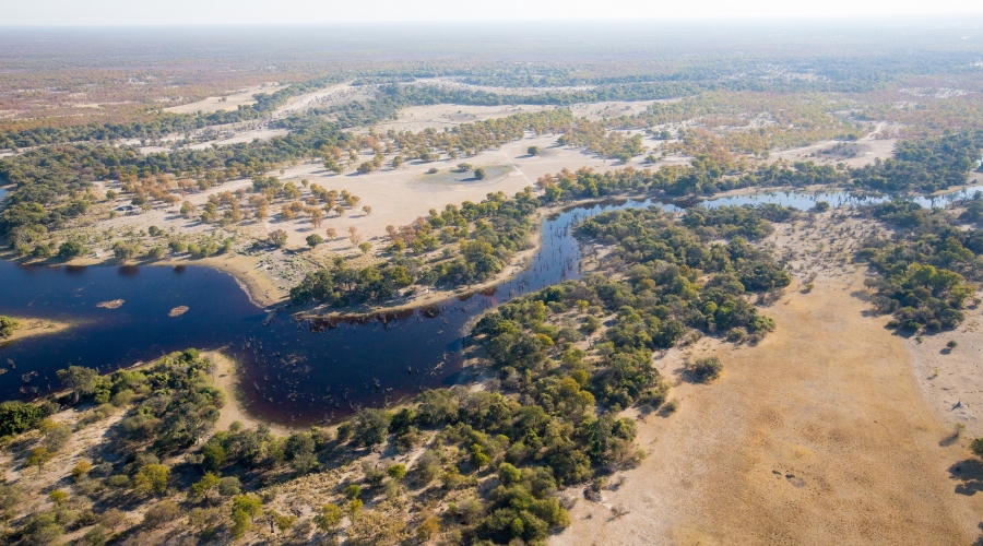
The 22000 square-kilometer Okavango delta is one of the world’s largest inland deltas
Over 2000 multi-disciplinary geoscience datasets have been downloaded free-of-charge from the Botswana Geoscience Portal since its launch in 2016. Mineral explorers, government and academic researchers, and other key stakeholders from more than 35 countries have visited the public repository to access the 10 gigabytes of pre-competitive geoscience data stored online. The portal, developed to promote and stimulate exploration activity in the Ngamiland region in northwestern Botswana, is a collaborative partnership between the Botswana Geoscience Institute (BGI), the mineral resource industry and Geosoft, who developed and host the portal.
“The response from the geoscience community in Botswana has been very positive,” says Tiyapo Hudson Ngwisanyi, Chief Executive Officer at the BGI, “Raw geoscientific data is critical in the mineral industry because people can manipulate it in such a way that it brings out features that they need.”
Ngwisanyi hopes that as the technology used to integrate and visualize exploration data evolves, data archived in the portal can be reprocessed in new ways to uncover previously hidden features, and attract new investment to Botswana from around the world.
“It is important for our government to safeguard all data that has been collected so that it can be used by others,” explains Ngwisanyi, “To have comprehensive data in one place eliminates the need to re-do certain surveys and reduces the cost to those companies.”
Geosoft developed and deployed the user-friendly Botswana Geoscience Portal using their experience with data services, portal development and geoscience data servers to catalogue, verify and deliver BGI’s geoscience data.
“We have been monitoring the use of the portal on behalf of the BGI,” says Troy Wilson, Senior Director of Strategy and Business Development with Geosoft. “The top five countries downloading data are Australia, Botswana, South Africa, the UK, and Canada, along with a significant number of resource companies. It was great to see that the second-largest number of data consumers came from Botswana.”
To date, the most popular downloads are the raw geophysical and geochemical datasets, but the release of the IGS prospectivity maps in August and Ngamiland magnetic inversion results in November saw large spikes in the number of downloads. New datasets are regularly being added to the portal.
Building on the success of the Botswana Geoscience Portal, Geosoft’s Government Segment Team is actively engaging with international government agencies seeking to improve access to their data repositories. “Geosoft is developing new ways to empower governments to curate their geoscientific data and collaborate openly with other government agencies and industry stakeholders,” said Wilson. “There’s an urgent industry need for more jurisdictions to make pre-competitive data available to stimulate exploration, and we’re excited to play a role in meeting that need.“
Geosoft will be presenting on the benefits of publishing open geoscience datasets on spatially enabled web portals during the 2017 Prospectors and Developers Association of Canada (PDAC) conference in Toronto on Sunday, March 5, 2017 at 4:00pm at the Metro Toronto Convention Centre, South, Booth 931. Registration for the presentation on The Role of Government and Industry in Maximizing the Value of Pre-Competitive Data in Exploration is available online.
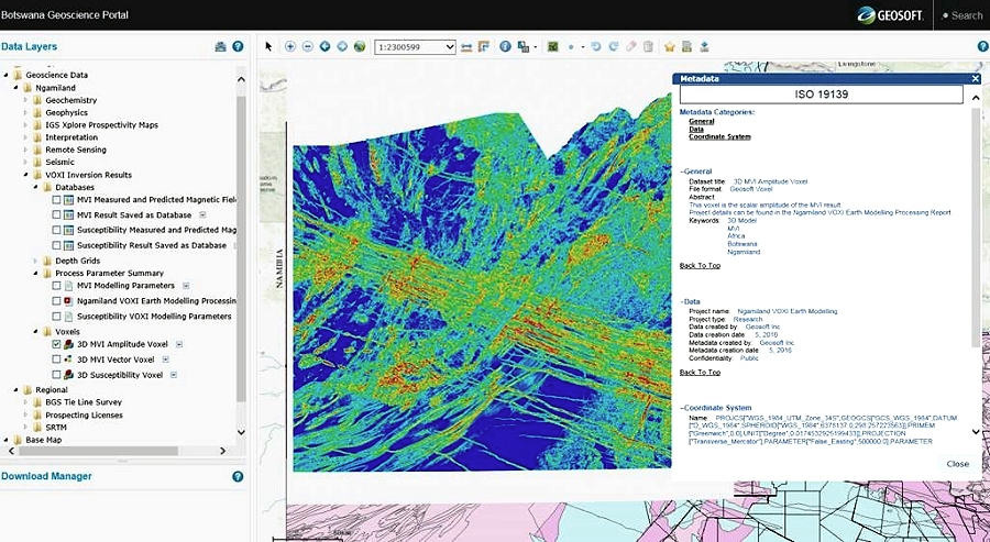
A regional-scale inversion of magnetic field data in the Ngamiland region of northwestern Botswana adds clear 3D images of the shallow crust beneath the Okavango delta region. The inversions are available for download from the Botswana Geoscience Portal.
About Geosoft
Since 1986 Geosoft has helped to advance exploration of the Earth’s subsurface. The company provides geoscience software and data services for government, energy and mineral exploration, marine, unexploded ordnance and the earth sciences. Visit www.geosoft.com.