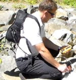
Den – Ham February 20, 2014 – For more than 25 years GEOSENSE has provided expertise in remote sensing, mining exploration, and geological mapping, along with the latest field instruments. At PDAC we will be demonstrating SPECTRAL EVOLUTION’S field portable spectrometer with EZ-ID software for mineral identification.
GEOSENSE offers a wide range of services for regional exploration, project scale mapping, drillcore logging, and environmental impact analysis. Ask about our unmanned aircraft in addition to our geological remote sensing services. Through our URSUS Airborne partnership, we can offer both unmanned planes and helicopters for your geological remote sensing and mapping projects.
SPECTRAL EVOLUTION spectrometers deliver the capabilities necessary to quickly identify minerals of interest, save on drilling costs in the field, and save on assay costs in the core shack.
All spectrometers are equipped with the exclusive DARWin SP Data Analysis software package so you can take advantage of the following analysis features:
Now with EZ-ID software, you can quickly identify minerals and take advantage of the following features:
For further information see:
or: http://www.Ursus-airborne.com
or: http://www.spectralevolution.com