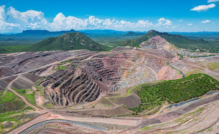
TORONTO, ONTARIO–(Marketwire – July 9, 2012) – Liberty Silver Corp. (TSX:LSL)(OTCBB:LBSV) (“Liberty Silver” or the “Company”) is pleased to announce results of the first phase of its 2012 drilling program in the Trinity silver mining district in Pershing County, Nevada. Drilling was directed to the exploration of selected areas adjacent to the resource zone identified in the Company’s 2011 NI 43-1012 technical report (the “Resource Area”), as well as confirmation of that resource.
Highlights
Bill Tafuri, President and COO, said, “We are extremely pleased with the results from phase one of our 2012 drilling program. Trinity is a large, high quality asset that provides us with a relatively low-risk opportunity to expand the known Resource, and also has high quality exploration targets. We are very excited about the potential revealed by the first phase of drilling.”
PROGRAM HIGHLIGHTS
Eighteen vertical drill holes were completed to depths of up to 1,500 feet in rhyolite and underlying metasedimentry host rocks by reverse circulation for a total of [20,030] feet. Drilling tested parts of five (5) geographic domains in the vicinity of the southern end the Trinity open pit mine and the 43-101 Resource Area. Sixteen holes intercepted sample intervals greater than 1 opt silver (“Ag”) with grades as high as 15 opt Ag. Sulfide zone samples contain up to 1.7 % lead (“Pb”) and 1.6 % zinc (“Zn”). A map of the location of the drill holes can be found on the Company’s website at: www.libertysilvercorp.com.
In addition to 18 holes drilled during phase 1 of the 2012 drilling program, approximately 395 holes were drilled during the period from 1982-2007, mainly by US Borax. While approximately 50 of these holes are widely spaced throughout the approximate 13 square-mile area of interest, the large majority are located within an approximate one square mile area centered on the Trinity open pit silver mine. Based on historical1 and current assays, all holes contain anomalous silver throughout. The non-43-101-compliant average grade for all 413 holes is 0.70 opt Ag.
The following Table summarizes the oxide mineralization encountered in the drilling:
Domain | Hole | From | To | Interval | Interval | Ag | Ag |
Name | (feet) | (feet) | (feet) | (meters) | opt | g/t | |
D1 | A12-8 | 0.0 | none | ||||
D1 | A12-9 | 0.0 | none | ||||
D1 | A12-10 | 125.0 | 150.0 | 25 | 7.6 | 0.57 | 17.73 |
D2 | A12-1 | none | |||||
D2 | A12-2 | 80.0 | 90.0 | 10 | 3.0 | 1.02 | 31.72 |
D2 | A12-3 | 105.0 | 115.0 | 10 | 3.0 | 0.76 | 23.64 |
D2 | A12-6 | 0.0 | none | ||||
D3 | A12-4 | 30.0 | 95.0 | 65 | 19.8 | 1.15 | 35.77 |
inc | 60.0 | 90.0 | 30 | 9.1 | 1.45 | 45.10 | |
inc | 75.0 | 90.0 | 15 | 4.6 | 1.86 | 57.85 | |
110.0 | 120.0 | 10 | 3.0 | 0.87 | 27.06 | ||
D3 | A12-5 | 10.0 | 95.0 | 85 | 25.9 | 0.99 | 30.79 |
inc | 70.0 | 95.0 | 25 | 7.6 | 1.46 | 45.41 | |
D4 | A12-7 | 10.0 | 85.0 | 75 | 22.9 | 0.82 | 25.50 |
inc | 60.0 | 75.0 | 15 | 4.6 | 1.13 | 35.14 | |
D4 | A12-11 | 10.0 | 65.0 | 55 | 16.8 | 1.12 | 34.83 |
inc | 10.0 | 45.0 | 35 | 10.7 | 1.38 | 42.92 | |
140.0 | 150.0 | 10 | 3.0 | 0.62 | 19.28 | ||
D4 | A12-12 | 15.0 | 45.0 | 30 | 9.1 | 0.63 | 19.59 |
60.0 | 85.0 | 25 | 7.6 | 0.71 | 22.08 | ||
125.0 | 145.0 | 20 | 6.1 | 0.9 | 27.99 | ||
inc | 125.0 | 135.0 | 10 | 3.0 | 1.22 | 37.94 | |
D4 | A12-17 | 10.0 | 50.0 | 40 | 12.2 | 1.96 | 60.96 |
inc | 10.0 | 30.0 | 20 | 6.1 | 3.27 | 101.70 | |
100.0 | 115.0 | 15 | 4.6 | 0.93 | 28.92 | ||
130.0 | 165.0 | 35 | 10.7 | 4.37 | 135.91 | ||
inc | 145.0 | 165.0 | 20 | 6.1 | 7.05 | 219.26 | |
inc | 150.0 | 155.0 | 5 | 1.5 | 9.9 | 308.00 | |
inc | 155.0 | 160.0 | 5 | 1.5 | 15.66 | 487.00 | |
D4 | A12-18 | 15.0 | 30.0 | 15 | 4.6 | 0.56 | 17.42 |
80.0 | 95.0 | 15 | 4.6 | 0.78 | 24.26 | ||
D5 | A12-13 | 20.0 | 140.0 | 120 | 36.6 | 0.69 | 21.46 |
inc | 110.0 | 120.0 | 10 | 3.0 | 1.14 | 35.45 | |
D5 | A12-14 | 15.0 | 75.0 | 60 | 18.3 | 0.71 | 22.08 |
inc | 15.0 | 25.0 | 10 | 3.0 | 1.26 | 39.19 | |
110.0 | 130.0 | 20 | 6.1 | 0.79 | 24.57 | ||
155.0 | 205.0 | 50 | 15.2 | 0.75 | 23.33 | ||
D5 | A12-15 | 20.0 | 45.0 | 25 | 7.6 | 0.9 | 27.99 |
inc | 30.0 | 45.0 | 15 | 4.6 | 1.07 | 33.28 | |
140.0 | 165.0 | 25 | 7.6 | 0.57 | 17.73 | ||
D5 | A12-16 | 85.0 | 95.0 | 10 | 3.0 | 0.54 | 16.79 |
155.0 | 165.0 | 10 | 3.0 | 0.69 | 21.46 |
The Following Table summarizes the deeper sulfide mineralization as well as base metals of interest:
Domain | Hole | From | To | Interval | Interval | Ag | Ag | Pb | Zn | Cu |
Number | Name | (feet) | (feet) | (feet) | (meters) | opt | g/t | % | % | % |
D1 | A12-8 | 620 | 635 | 15 | 4.57 | 1.35 | 41.99 | 0.03 | 0.04 | – |
D1 | A12-9 | 630 | 640 | 10 | 3.05 | 1.1 | 34.21 | 0.08 | 0.06 | – |
D1 | A12-10 | 640 | 655 | 15 | 4.57 | 4.48 | 139.33 | 0.11 | 0.10 | – |
inc | 640 | 645 | 5 | 1.52 | 11.9 | 370.00 | 0.28 | 0.23 | 0.01 | |
D2 | A12-1 | 520 | 565 | 45 | 13.72 | 1.04 | 32.34 | 0.05 | 0.04 | – |
575 | 585 | 10 | 3.05 | 1.76 | 54.74 | 0.13 | 0.12 | – | ||
790 | 800 | 10 | 3.05 | 0.64 | 19.90 | 0.02 | 0.02 | – | ||
1000 | 1010 | 10 | 3.05 | 3.18 | 98.90 | 0.03 | 0.04 | – | ||
1010 | 1045 | 35 | 10.67 | 1.07 | 33.28 | 0.01 | 0.02 | – | ||
D2 | A12-2 | 475 | 490 | 15 | 4.57 | 0.76 | 23.64 | 0.04 | 0.03 | – |
635 | 645 | 10 | 3.05 | 0.71 | 22.08 | 0.02 | 0.03 | – | ||
D2 | A12-3 | 205 | 225 | 20 | 6.10 | 0.58 | 18.04 | 0.02 | 0.05 | – |
420 | 450 | 30 | 9.15 | 1.31 | 40.74 | 0.10 | 0.08 | – | ||
inc | 425 | 435 | 10 | 3.05 | 2.05 | 63.76 | 0.20 | 0.15 | – | |
D2 | A12-6 | 695 | 715 | 20 | 6.10 | 1.56 | 48.52 | 0.12 | 0.08 | – |
inc | 705 | 715 | 10 | 3.05 | 2.68 | 83.35 | 0.21 | 0.13 | – | |
745 | 760 | 15 | 4.57 | 1.49 | 46.34 | 0.08 | 0.08 | – | ||
D3 | A12-4 | 155 | 165 | 10 | 3.05 | 1.24 | 38.56 | 0.06 | 0.11 | – |
180 | 190 | 10 | 3.05 | 0.74 | 23.01 | 0.06 | 0.11 | – | ||
205 | 240 | 35 | 10.67 | 1.78 | 55.36 | 0.09 | 0.10 | – | ||
295 | 305 | 10 | 3.05 | 0.74 | 23.01 | 0.10 | 0.13 | – | ||
310 | 330 | 20 | 6.10 | 1.2 | 37.32 | 0.15 | 0.20 | – | ||
inc | 310 | 320 | 10 | 3.05 | 1.8 | 55.98 | 0.18 | 0.29 | – | |
345 | 400 | 55 | 16.77 | 1.57 | 48.83 | 0.17 | 0.15 | – | ||
410 | 435 | 25 | 7.62 | 0.72 | 22.39 | 0.25 | 0.20 | – | ||
inc | 435 | 445 | 10 | 3.05 | 1.64 | 51.00 | 0.11 | 0.10 | – | |
555 | 570 | 15 | 4.57 | 1.7 | 52.87 | 0.14 | 0.10 | – | ||
D3 | A12-5 | 95 | 120 | 25 | 7.62 | 1.68 | 52.25 | 0.08 | 0.15 | – |
225 | 240 | 15 | 4.57 | 0.53 | 16.48 | 0.14 | 0.19 | – | ||
280 | 305 | 25 | 7.62 | 0.6 | 18.66 | 0.43 | 0.33 | 0.01 | ||
545 | 565 | 20 | 6.10 | 0.63 | 19.59 | 0.77 | 1.00 | 0.02 | ||
640 | 650 | 10 | 3.05 | 0.55 | 17.11 | 0.51 | 0.41 | 0.01 | ||
D4 | A12-7 | 515 | 545 | 30 | 9.15 | 0.73 | 22.70 | 0.83 | 0.75 | 0.02 |
745 | 775 | 30 | 9.15 | 0.61 | 18.97 | 0.83 | 0.66 | 0.03 | ||
785 | 795 | 10 | 3.05 | 1 | 31.10 | 0.34 | 0.29 | 0.01 | ||
D4 | A12-11 | 505 | 515 | 10 | 3.05 | 0.94 | 29.23 | 1.30 | 0.65 | – |
D4 | A12-12 | 0.00 | none | |||||||
D4 | A12-17 | 165 | 180 | 15 | 4.57 | 1 | 31.10 | 0.33 | 0.26 | 0.01 |
D4 | A12-18 | 0.00 | none | |||||||
D5 | A12-13 | 300 | 315 | 15 | 4.57 | 4.16 | 129.38 | 0.10 | 0.08 | – |
440 | 460 | 20 | 6.10 | 1.15 | 35.77 | 0.11 | 0.11 | – | ||
485 | 495 | 10 | 3.05 | 0.59 | 18.35 | 0.30 | 0.26 | – | ||
510 | 540 | 30 | 9.15 | 0.98 | 30.48 | 0.53 | 0.32 | – | ||
980 | 990 | 10 | 3.05 | 1.41 | 43.85 | 0.12 | 0.18 | – | ||
D5 | A12-14 | 365 | 380 | 15 | 4.57 | 0.77 | 23.95 | 0.37 | 0.31 | – |
D5 | A12-15 | 305 | 315 | 10 | 3.05 | 0.54 | 16.79 | 0.41 | 0.34 | – |
365 | 375 | 10 | 3.05 | 0.96 | 29.86 | 0.18 | 0.06 | – | ||
390 | 450 | 60 | 18.29 | 1.06 | 32.97 | 0.16 | 0.09 | – | ||
760 | 780 | 20 | 6.10 | 0.69 | 21.46 | 0.44 | 0.49 | 0.01 | ||
D5 | A12-16 | 165 | 180 | 15 | 4.57 | 0.78 | 24.26 | 0.06 | 0.09 | – |
405 | 415 | 10 | 3.05 | 0.62 | 19.28 | 0.04 | 0.03 | – | ||
495 | 505 | 10 | 3.05 | 0.68 | 21.15 | 0.23 | 0.18 | – |
Notes: |
Ag grades are calculated using 0.5 opt cut off and minimum 10 ft reporting thickness. |
All holes are exterior to the geographical area of the MDA NI 43-101 resource except holes A12-4 and -5. |
inc. = including |
The three holes drilled in Domain 1, penetrated to depths of 1,040 to 1,120 ft and contain weakly anomalous Ag throughout. Very thin horizons of Ag at 1.2 to 5.1 opt Ag are found spatially associated with speculated fault zones at 635 to 700 ft depths.
Domain 2 (Holes A12-1, -2, -3 and -6) is located immediately southwest of the south end of the Trinity pit. Holes A12-1 and A12-6 host no oxide Ag above 0.5 opt but do contain sulfide Ag averaging 0.90 opt and 0.95 opt Ag, respectively with grades improving at depth. A12-2 contains 1.0 opt oxide Ag at a depth of 80 to 90 ft while A12-3 contains 0.77 opt oxide Ag from 105-115 ft deep.
Domain 3 includes holes A12-4 and A12-5, which were drilled to confirm grade within the Resource Area, in the area south of the south end of the Trinity open pit mine. Hole A12-4 exhibits up to 4.3 opt Ag and averages 0.39 opt Ag from surface to 1,275 ft depth, 0.65 opt Ag from surface to 675 ft depth in rhyolite terrain, and 0.77 opt Ag from surface to 120 ft depth in the oxide zone including 1.2 opt Ag at 30-95 ft depth. Hole A12-5 exhibits up to 2.9 opt Ag and averages 0.23 opt Ag from surface to 1,500 ft depth, 0.49 opt Ag from surface to 490 ft depth in rhyolite terrain, 0.91 opt Ag from surface to 95 ft depth in the oxide zone including 1.2 opt Ag at 30-95 ft depth.
Drilling results in Domain 4 (Holes A12-7, -11, -12, -17, and -18 drilled along and outside the east side of the Resource Area.) indicate a potential new extension from the original pit and Resource Area. Hole A12-17, intersected significant silver mineralization in the oxide zone with individual 5 ft-thick samples ranging up to 15 opt Ag. Samples at 145 to 170 ft depth average 5.9 opt Ag and the entire oxide zone at 0 to 165 ft depth averages 1.6 opt Ag. The rhyolite host rock at surface to 665 ft depth averages 0.55 opt Ag. In the reduced zone below 165 ft. and down to 665 ft. depth Pb + Zn range up to 1% and 0.5 %, respectively, and average 0.5% Pb and Zn with 0.19 opt Ag. Holes A12-11 and A12-7, situated up to 250 ft south of A12-17 demonstrate grades of up to 2.1 and 1.4 opt Ag, respectively.
The holes drilled in Domain 5 (Holes A12-13, -14, -15, -16) are step outs from the south end of the Trinity open pit mine and sited on the east and south borders of the Resource Area. Similar to Domain 4, results in Domain 5 also indicate a potential new extension. Hole A12-13 exhibits scattered strong silver throughout, including 10 opt Ag at 305 ft depth and 2.7 opt silver at 985 ft depth. The rhyolite host rock at surface to 475 ft depth averages 0.48 opt silver including 0.73 opt oxide silver at 25 to 120 ft depth. Pb+Zn average 0.65% with 0.74 opt silver at 485 to 540 ft depth in metasediments below Ag-bearing rhyolite terrane. Hole A12-14 exhibits individual sample grades of up to 1.9 opt silver in the oxide zone where it averages 0.60 opt silver from the surface to 165 ft depth. The entire oxide zone at surface to 230 ft depth averages 0.55 opt silver. Pb+Zn average 0.65 % with 0.74 opt silver at 485 to 540 ft depth at the bottom of rhyolite terrane.
“In addition to the strong results provided by our phase 1 program, we have identified multiple exploration targets through the vast amount of historic drilling and our recently completed geophysics program. We have diligently analyzed and inputted all the historic and new data into a comprehensive GIS database and are constructing 3D models to further define the multiple opportunities the Trinity property contains,” concluded Mr. Tafuri.
Quality Assurance / Quality Control
All drill hole samples were analyzed using ICP-MS by American Assay Laboratories, Reno, Nevada. Analytical precision and accuracy were monitored by Minerals Exploration and Environmental Quality, Reno, Nevada, including the use of certified reference materials (standards), blank samples, and duplicate samples. A senior Liberty Silver geologist supervised drill hole sample collection by the driller, Boart Longyear, Elko, Nevada, at the drill site and chain of custody throughout the program was unbroken. Drill hole deviation surveys were done by IDS, Elko, Nevada.
Tim Percival, MA, AIPG, of Reno, Nevada, a consultant to Liberty Silver has reviewed the technical data in this press release and is a Qualified Person as defined by NI 43-101.
Notes:
1 | The historic drilling that was used in calculating this average was undertaken in accordance with standards at the time, but was not supervised by a qualified person in accordance with current NI43-101 standards. These results are reported here for reference only and should not be relied upon. |
About Liberty Silver Corp.
Liberty Silver Corp. is focused on exploring and developing mineral properties located in North America. The Company is led by a skilled, experienced, management team and board of directors with significant experience managing exploration, development and mining projects. The Company is committed to creating value for its shareholders by advancing its current projects utilizing its mitigated risk approach to production, developing new resources on its current properties, and by acquiring new properties that have the potential to increase their resource base. The Trinity Silver project, located in Pershing County, Nevada is the Company’s flagship project. Liberty Silver has the right to earn a joint venture interest in the 10,476 acre Trinity property from Renaissance Gold Inc. (“Renaissance”) pursuant to the terms of an Earn‐In Agreement.
Cautionary Statements
This News Release includes certain “forward-looking statements”. These statements are based on information currently available to the Company and the Company provides no assurance that actual results will meet management’s expectations. Forward-looking statements include estimates and statements that describe the Company’s future plans, objectives or goals, including words to the effect that the Company or management expects a stated condition or result to occur. Forward-looking statements may be identified by such terms as “believes”, “anticipates”, “expects”, “estimates”, “may”, “could”, “would”, “will”, or “plan”. Since forward-looking statements are based on assumptions and address future events and conditions, by their very nature they involve inherent risks and uncertainties. Actual results relating to, among other things, results of exploration, project development, reclamation and capital costs of the Company’s mineral properties, and the Company’s financial condition and prospects, could differ materially from those currently anticipated in such statements for many reasons such as: changes in general economic conditions and conditions in the financial markets; changes in demand and prices for minerals; litigation, legislative, environmental and other judicial, regulatory, political and competitive developments; technological and operational difficulties encountered in connection with the activities of the Company; and other matters discussed in this news release and in filings made with Securities Regulators. This list is not exhaustive of the factors that may affect any of the Company’s forward-looking statements. These and other factors should be considered carefully and readers should not place undue reliance on the Company’s forward-looking statements. The Company does not undertake to update any forward-looking statement that may be made from time to time by the Company or on its behalf, except in accordance with applicable securities laws.
The Toronto Stock Exchange does not accept responsibility for the adequacy or accuracy of this release. No stock exchange, securities commission or other regulatory authority has approved or disapproved the information contained herein.
Liberty Silver Corp.
Manish Z. Kshatriya
Executive VP & CFO
(888) 749-4916
[email protected]
Liberty Silver Corp.
Kevin O’Connor
Investor Relations
(416) 962-3300
[email protected]
www.libertysilvercorp.com