Maximize Tailings Capacity and Freeboard Measurement
Determine the remaining capacity of your tailings storage facility and meet reporting requirements.
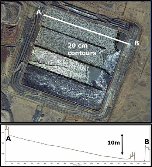
TAILINGS BEACH SURVEYS
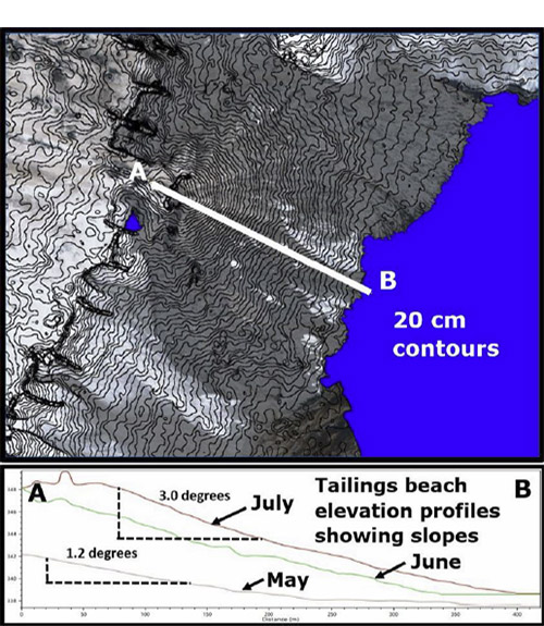
Slope measurements accurate to a fraction of a degree.
Lift thickness
Measurement from the edge of the beach to the edge of the standing water.
VOLUME MEASUREMENTS
Simultaneous measurements of tailings, ore stockpiles, waste dumps and mine pits.
SPEED
Delivering within days of photo collection.
Accurately map tailings pond margins and beach lengths
PhotoSat accurately maps tailings pond margins using a combination of the tailings beach slopes and the optical properties of the solid tailings and the water. Accurate mapping of tailings pond margins provides accurate beach lengths measured from the edge of the beach to the water line.

Determine the remaining capacity of your Tailings Storage
Determining the remaining capacity of your TSF requires accurate and repeatable determination of the edge of the pond and high-density elevation measurements on the beach. Measuring and monitoring tailings beach slopes and the thicknesses of the pours over time verifies TSF capacity models.
Measure tailings beach slopes
The vertical accuracy of PhotoSat surveying enables you to measure the slopes of tailings beaches to a fraction of a degree. Increasing tailings beach slopes increases the capacity of the TSF. Tailings beach slopes can be modified by the addition of thickeners and by adjusting the flow volumes from individual tailings spigots.
Get a proposal for your mine site, contact us at 604 681-9770


Comments